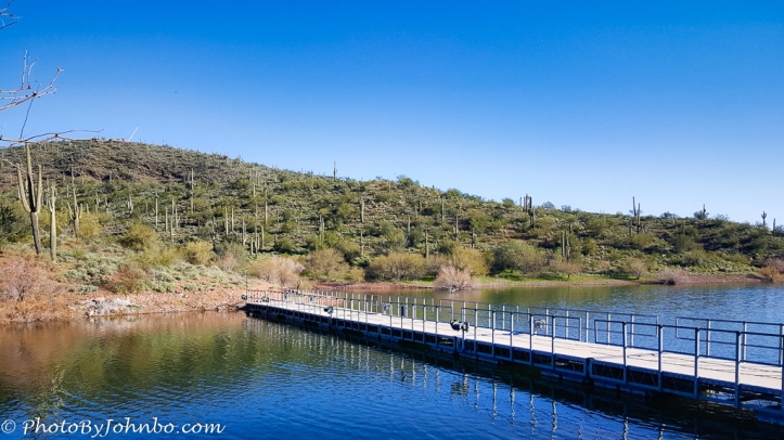
In the northwestern Phoenix metro area, Lake Pleasant Regional Park beckons on those hot summer days. But I’ve never been there then. Due to my heavy travel schedule this winter, I only led one hike in February, so I wanted it to be a good one. I picked Pipeline Canyon Trail, my favorite trail in Lake Pleasant Park. A relatively level trail with only about a 600-foot (183 m) altitude change, it’s only two miles in length. But there is a small parking lot with rest rooms at each end and after a short break, it’s another two miles back to the cars. We completed the hike in less than 2 hours on a beautiful spring morning.
The park is known for its wild burros, but in the years I’ve visited the park, I’d never seen them, until today, a small herd of nine calmly stood on a nearby hillside as we walked by. Of course, I grabbed a bunch of cellphone pics, but you’ll notice in the image above, not a burro is in sight. Cellphone cameras are great for wide angle images, but when it comes to needing good telephoto capabilities, my Samsung S6 is lacking. Yes, I could zoom in on the image to see the tiny fuzzy outlines of the burros we saw, but the resulting image was not the quality I’d like to share.
About the photo: The lake is the result of a water storage dam that captures water from the Colorado and Agua Fria Rivers to be delivered to homes and farms in the area throughout the long, dry summers. One of the runoff areas from the nearby hills is now a backwater area that bisects the Pipeline Canyon Trail. A floating bridge is there to reconnect the trail segments. You’ll find this bridge about a 5 to 10 minutes hike from the south end of the trail. Captured with my Samsung S6, the image was imported into Lightroom, then tweaked with Luminar Flex.
John Steiner


My wonderful wife and I just returned from a nine-day visit to the Phoenix area. We are both more determined than ever to move there ASAP.
With changes in my life and COVID-19, we are staying in AZ an extra month than planned.