
Maricopa County, Arizona.
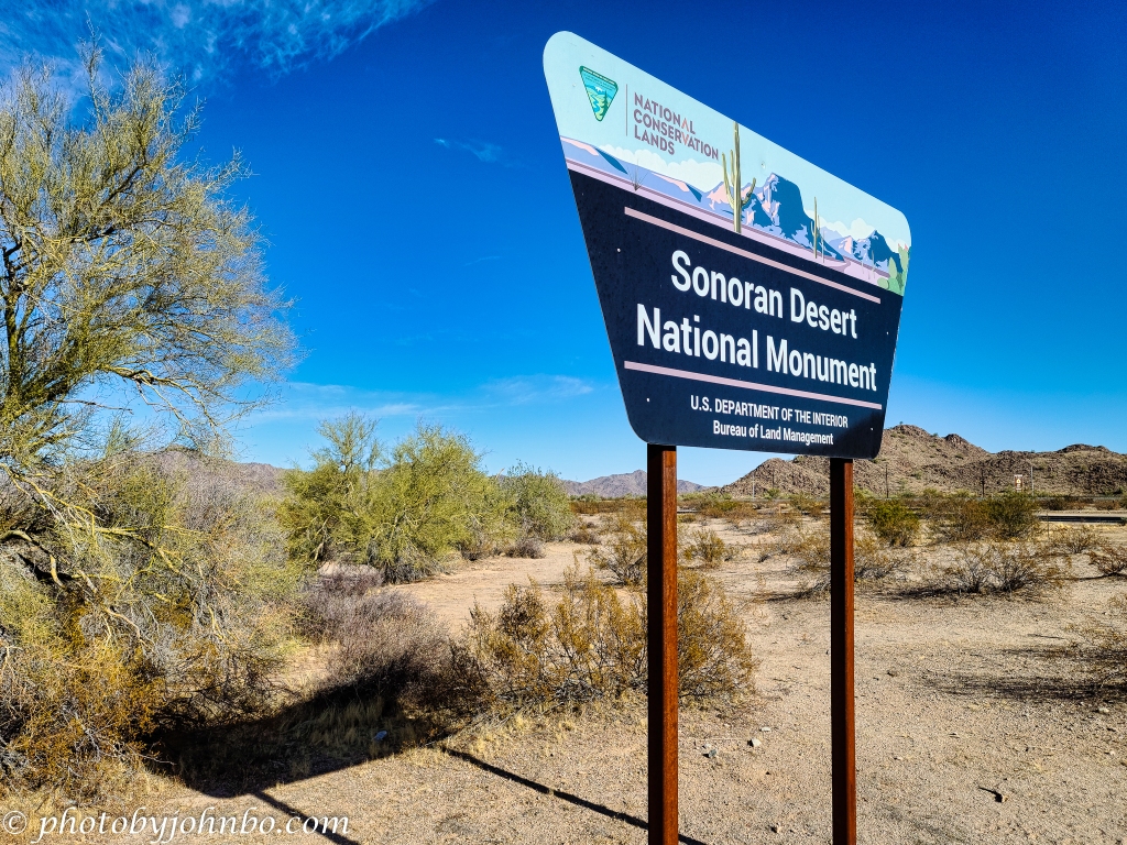
We often take I-8 from Gila Bend to the Tucson area, but last year we decided to take a scenic route to Maricopa (the community south of the Phoenix metro.) Highway 238 out of Gila Bend winds its way through the Sonoran Desert to Maricopa. On the way, we noticed the sign in the image above through locked gates.
A little research told me that there are three sections to the park. This access is about four miles (6.4 km) east of Gila Bend on Highway 238. The reason for the locked gates is that there is a temporary motor vehicle closure (that’s been in place for many years). This part of the park is accessible by horseback and for hiking. Parking is available for access to the section which leads to the Juan Bautista de Anza National Historic Trail. The trail parallels three major routes, the Butterfield Overland Stage Route, the Mormon Battalion Trail, and the Gila Trail.

Though the road is blocked for vehicles, this entrance road has recent vehicle tracks, no doubt made by park ranger vehicles. It would have been fun to go for a short hike on the day I took these cellphone pictures, but we had an appointment in Maricopa, so I only had a few minutes to capture some of the views of this section of the national monument.

For those who prefer motorized tours, you can access the Sand Tank Mountains south of I-8 via Exit 140, Freeman Road. That area is known as the Barry M. Goldwater Range and requires a permit. That permit is free and is valid for one year, but requires the recipient to watch a 13-minute safety video. That permit is available here. In this section of the national monument, motorized vehicles are allowed but must remain on existing routes.

There are more than 460 miles (740 km) of back-country, off-highway roads, and primitive trails, but there are wilderness areas where vehicles of any type are prohibited, hiking and horseback only.
South of I-8, the eastern Tabletop Wilderness Area is accessible via Exit 144, Vekol Road. The Sonoran Desert is remote in these areas with primitive access and low-maintenance roads. Cell phones are not functional in many areas of the park. The best times to visit are October to April. In the summer, temperatures may exceed 110 degrees F. (37.7 degrees C.) Make sure your gas tank is full, carry extra water, and make sure your vehicle is in excellent working order.
A PDF map of the Sonoran Desert National Monument is available here.
For those who like to pixel peep at the 2K HD photos, click on the images above to view them on my Flickr site. Alternatively, you can visit the Flickr album here.
John Steiner

It’s amazing that the Saguaro cactus only grows in the United States and Mexico, and nowhere else in the world.
It is an interesting anomaly, Hien. I understand it’s because only that part of the world has the exact amount of rain during the monsoons and the correct temperature range to support this large and beautiful plant.
I hope that climate change isn’t detrimental to the species.
I still remember driving from NM toward AZ, and as soon as you saw the Saguaro, you knew you were close!
Coming south on I-17, you are descending from the higher elevations and going around a curve, you see your first saguaro.
The skies in these images are fabulous!
Beautiful composition of the Saguaro cactus and mountains behine. The blue sky and clouds, Wow…
Thanks, Amy! That discovery is another reason to take the roads less traveled. 🙂
Such a harsh environment, and yet stunningly beautiful. No wonder people have found food for their souls in the desert since biblical times!
Indeed!