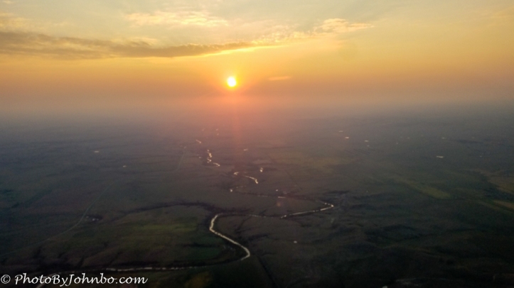
 Somewhere over South Dakota.
Last week, two air crews from North Dakota Wing Civil Air Patrol spent some time in Houston working on an assignment from FEMA. I was the pilot for one of those air crews. We were doing aerial survey work tracking the aftermath of the Hurricane Harvey disaster. In a future Journeys With Johnbo, I will share some of my experiences on that journey. On Monday, our crews left Houston’s Ellington Field for Mandan, North Dakota where we split up and returned to our respective homes around the state. The flight from Houston is about nine hours in a Cessna 182 with two fuel stops. On this trip, we stopped at Stillwater, Oklahoma and O’Neill, Nebraska.
As we ventured across South Dakota around 7:45 PM local time, the sun was setting. It was easy to spot the smoke and haze layer that we were flying just above. We were witnessing the results of another natural disaster, the wildfires burning across Montana. As this is being written, media is reporting a dozen separate major fires burning in the state. The smoke from those fires travels eastward naturally and even in Fargo, some 350 miles (563 km) from the easternmost Montana border, our air quality is being affected by the smoke and haze.
About the photo: This image was captured on my Samsung S7 Cell phone at an altitude of about 5500 feet (1676 m) above the ground. A minimal amount of processing was done to increase the contrast to bring out some of the detail in the foreground. On some browsers, you can click on the image to enlarge it. The rule for Cellpic Sunday is simple. The image must be captured on a mobile device.
John Steiner

Simply gorgeous! The fact that you’re a pilot leads to all sorts of opportunities to take pics that others never have an opportunity to catalog. It’s nice to see ya’ taking advantage!
Every time I get in an airplane, I think about the privilege I have been given to have a skill that gives me a perspective that only a comparatively few people can acquire.