
Arco, Idaho.
This scenic byway in south-central Idaho starts on U.S. 20 at Shoshone, travels past Craters of the Moon National Monument northeast to Arco, and then north along U..S. 93 to Challis. On that northern leg, it parallels the Lost River Mountain Range. Some of the state’s highest mountains are in that range, including the highest mountain in the state, Mount Borah. Plan about 3 hours for the 140-mile (225 km) drive.
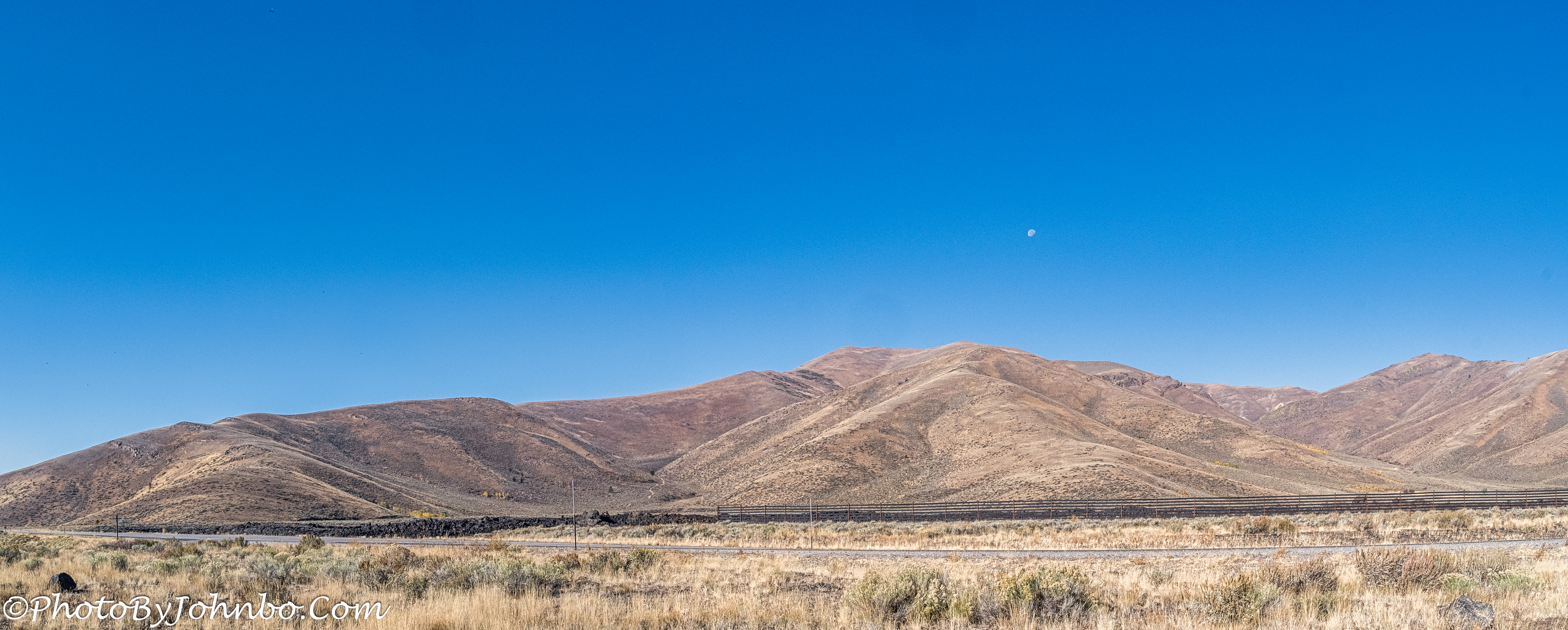
Our journey on this trip, however, covered only that portion between Shoshone and Arco. The opening image features a view of the Pioneer Mountains, a much shorter range than Lost River, that parallels the Craters of the Moon National Monument. The Pioneer Mountains mark an east-west shortcut for settlers in the 1850s as they tried to avoid skirmishes with the Shoshone Indians. That route, known as Goodale’s Cutoff ran along the base of these mountains.

On the other side of the road, the northern border of Craters of the Moon is easily identified as the flow of lava stopped there. In the background is the tallest of more than 25 cinder cone volcanoes. Big Cinder Butte is accessible via a road within the national monument. If you are planning a visit to the park, you can get a much closer view of this cinder cone volcano.

As you arrive at Arco, you will probably notice the large hill in the background above the city with a multitude of numbers painted on the hillside. To see the numbers clearly, you’ll need to click on the image to get the 4K HD Flickr image and then click twice to zoom in. Number Hill started gathering numbers when the Arco class of 1920 painted a large “20” onto a rock face on the hillside. Every year since then, the graduating class has memorialized their year on the mountainside. That begs the question so that it is now over a century since the painting began, did the class of 2020 paint their own “20” on the hill, or is the 1920 version good enough? What about 2021? I did not find an answer to those questions.

Given our choice to travel only the southwestern portion of the route, I noted that the byway starts at Shoshone. Well, the name belies that statement. Highway 93 near Challis and the Lost River Mountains mark the start of Peaks to Craters. The westbound highway to Shoshone marks the end of the byway as it connects to the Sawtooth Scenic Byway.
From Arco, to stay on the byway, you turn northwest on U.S. 93 toward MacKay and Challis. However, our next stop on our long journey is easterly so we continued on U.S. 26 and U.S. 20 toward Idaho Falls.

We would eventually find ourselves in the Snake River Valley. The image above features a view of the river near Idaho Falls. Strictly speaking, this image and the remaining images in the gallery are no longer on the byway, but the scenery between Arco and Idaho Falls is well worth the journey.
Click on the image above to get a close-up view and to see the entire gallery in 4K HD, if your browser allows. In Flickr, clicking an area of the image will give you a closer view if you only have an HD monitor.
John Steiner

I see those painted numbers. Will the students run out of mountain?
Well, if they are close to their centennial year, they can just start repainting the existing 2-digit numbers again. >grin<
That’s my sort of drive for sure! And I’d love to visit the Craters of the Moon too 🙂
We always look for the scenic drives when we can. We are almost never disappointed.