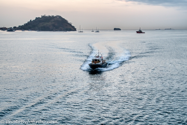
It was early morning when we entered the canal zone. Our trip, the second through the canal, would be from the Pacific Ocean to the Atlantic this time. Our original cruise in 2013 was in the opposite direction. Both trips started with the arrival of the Canal Zone Pilot who, along with a crew of workers would take over the responsibility of the ship’s safe transit through the canal, no doubt under the watchful eyes of the Norwegian Star’s captain.
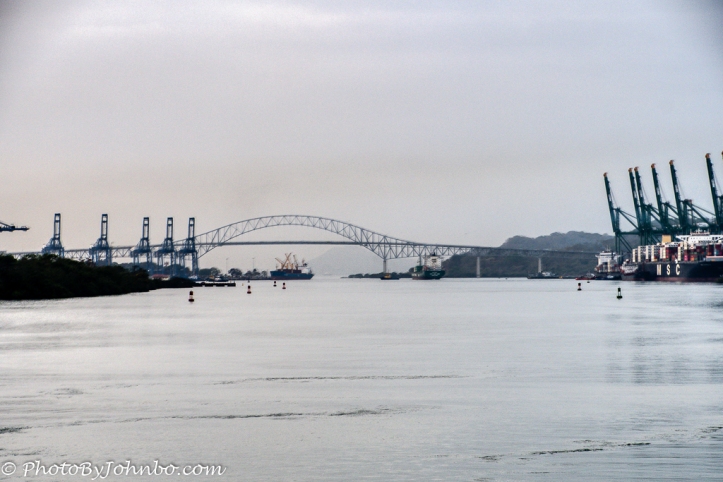 Ahead of us we could see the Bridge of the Americas, a pathway to reconnect the two continents after the canal separated them, built between 1959 and 1962. There are two other bridges that span the canal as well.
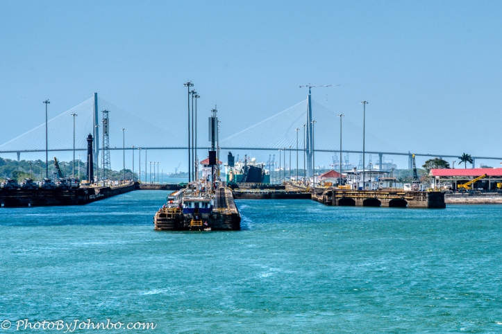
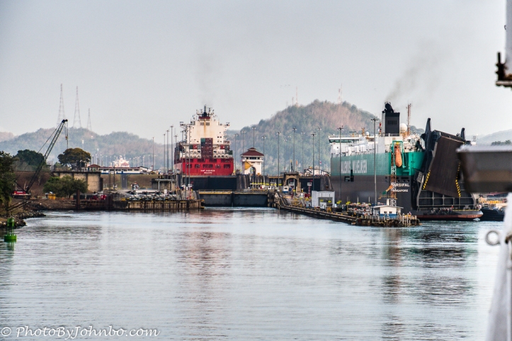 The Norwegian Star is a Panamax ship built to the dimensions required to transit the canal in 2001. Ships in this class are typically just wide and long enough to fit into the locks at the canal. Norwegian Cruise Line ships that meet the Panamax dimensions can support about 2300 passengers or so. In the image above, our ship is ready to turn into the lock chamber next to the large green car hauler to the right. That large black appendage at the rear of the car carrier is a ramp. Car haulers lower that ramp and vehicles being loaded or unloaded simply drive on or off the ship via the ramp.
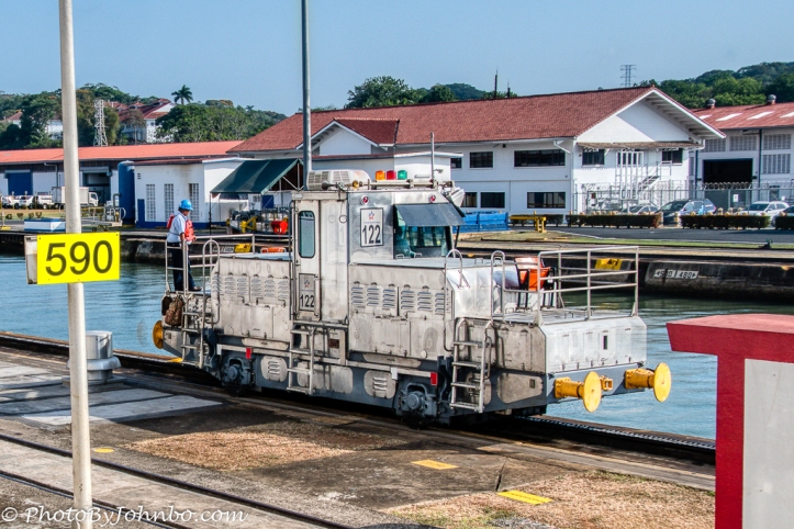
 As we begin the process of entering the lock chamber, a row boat with two crew bring the large ropes that eventually tie the ship to a tractor on the shore. The tractors, referred to as “mules” don’t actually pull the ship. Larger ships like the Norwegian Star are 16-line ships. Each mule controls four of the large ropes used to keep the ship centered in the lock.
The pilot maneuvers the ship into the center of the lock and the mules tighten their ends of the ropes, four mules to a side. The ropes keep the ship from moving side to side. As the lock water level raises and lowers, the mules spool the ropes in and out precisely so that the ship remains solidly in the center of the channel.
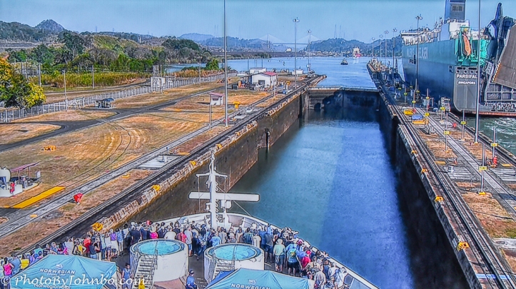 Throughout the process, a spokesperson uses the ship’s public address system to describe the progress through the canal system to all of the passengers. There is a camera on the ship’s bridge that shows the forward view so that passengers in cabins can watch the forward progress through the canal. This photo is a screen shot of the television image as viewed in our cabin.
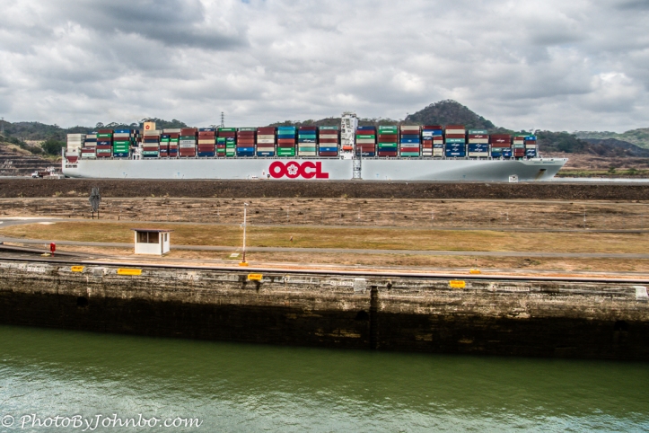 In 2013, our ship, the Norwegian Pearl was the largest ship to date to have transited the canal. If I recall correctly, they said the transit fee was $520,000 back then. Now that the new, larger locks are open for transit, much larger ships like this OOCL container ship can transit the canal. The sister ship to this OOCL line freighter paid the highest toll as of the date of our transit, some 1.8 million USD. It must be worth it to avoid the costs and time lost to transit the South American continent and use the larger locks of the Panama Canal instead.
 Though we think of the canal being cut east to west, it is really cut north to south. From the Pacific Ocean, it enters two sets of locks, Miraflores, then Pedro Miguel. From there, it transits the major portion of the canal dig, the Culebra Cut. As you may note from the photo above, they terraced the slope of the cut to help keep earth from refilling the canal by natural erosion as they dug. After transiting the cut, the ships enter Lake Gatun, a manmade lake that is about 90 feet (28 m) above the ocean levels.
At the north end of Lake Gatun, one more set of locks, the Gatun Locks lowers the ship through three chambers to the Caribbean Sea. The image above features a view of Lake Gatun. The image below of the lakeside entrance to the Gatun Locks.
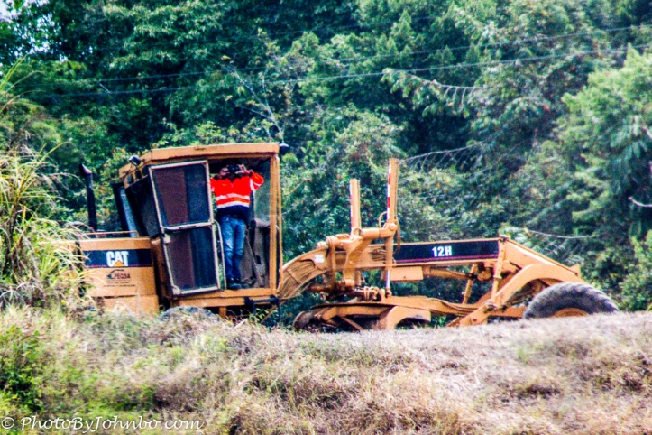
As we transited Lake Gatun, I noticed a workman along the shore standing at the door to his earth mover. 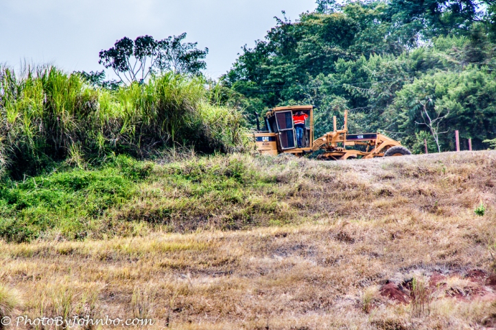
I couldn’t quite figure out what he was doing when I took the photo. Later, once I loaded the image into my computer and could zoom in, I could see what he was doing more clearly.
Apparently the sight of a cruise ship in the canal was worthy of his taking a cell phone photo. I suspect he sees a lot more freight haulers than cruise ships on his daily rounds. In 2013, I expected that would be our one and only trip through the canal, one of those “bucket list” items checked off and done. As it turns out, my sister and her friend also had the canal transit on their bucket list. They asked if we would like to accompany them on their journey. We didn’t hesitate to say, “Yes.” We saw some new (to us) countries, and revisited some places seen on the last trip through. It was well worth the second passage. I submit for your review a gallery of images. In most browsers, you can click on an image to enlarge it and to scroll through the gallery.
John Steiner


Wow… what a grand tour. Great photos, John! I’ve read “The Path Between the Seas” by David McCullough. Hop to see the canal soon.
Thanks! You have given me another book to read! Be sure to take that trip through the Canal. You’ll be glad you did.
What an experience, and such a marvel of engineering!
Indeed! At over a century old, it is amazingly functional in today’s advanced maritime operations.
[…] via Transiting the Panama Canal – 2019 Return — Journeys with Johnbo […]
I often find that I enjoy the second visit to a distant locale more than the first as navigation and such is far easier. Good read!
True that… and you can see places you missed the first time!