

Baker, Nevada.
On our westward journey in 2021, we traveled from Salt Lake City through Nevada and then west to Yosemite National Park in California. Instead of taking the direct route, we ventured south first along the Great Basin Scenic Highway, then via State Route 487 to the town of Baker, and then via State Route 488 to the park entrance and visitor center. The park is very near the Utah-Nevada border just outside of Baker.
Those interested in exploring caves via a guided tour will find the original Lehman Caves National Monument absorbed into the newly formed Great Basin National Park in 1986. We didn’t take the cave tour, although guided tours are offered all year. Be sure to reserve your tour appointment via the Recreation.gov website or you might not get to view the caves on the day you come to visit. I also noted while researching this post in early December 2022 that the caves will be closed in January and February 2023 due to some improvement projects underway. Tours will resume on March 1, and tours are limited in size, and a spot on the tour can be reserved up to 30 days in advance of your proposed visit. Reserve early in the summer as the cave tours sell out quickly.
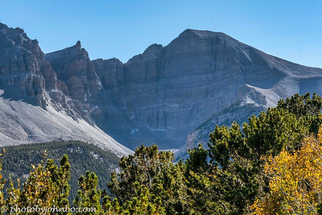
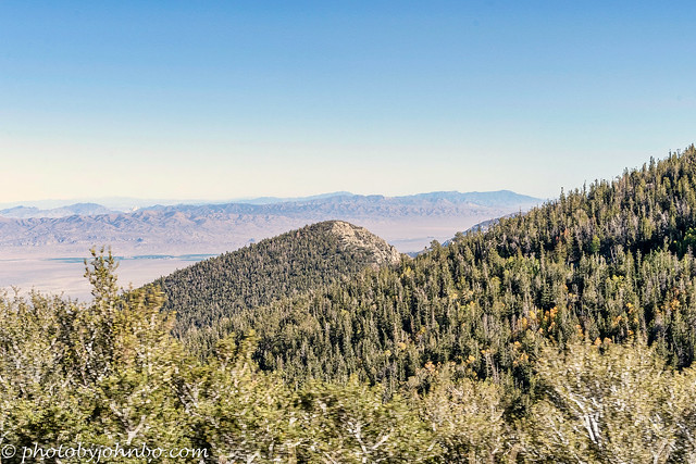
Instead of the cave tour, we decided to drive the mountain road toward Wheeler Peak, the terrain changing from desert in the Great Basin to evergreen forest, and then above the tree line into the high altitudes. Wheeler Peak summit is 13,065 feet (3982 m) above sea level and is the second-highest peak in the state. The desert surrounding the mountain is high, so the peak rises only some 7563 feet (2305 m) above the Great Basin. The views from the park highway are plentiful.

At one stop, a viewpoint is designed specially to get a view of Bald Mountain. There are several peaks named “Bald Mountain” in the southwest, so if you decide to look up specifics, be sure you’re looking at the Bald Mountain that’s located in the Great Basin National Park. The mountain isn’t one that attracts climbers, but the reward for climbing this summit is a spectacular view of Wheeler Peak. But don’t take my word for it. I didn’t climb Bald Mountain. I found that information on the Internet here. I settled for capturing this Cellpic from the scenic drive in the park.
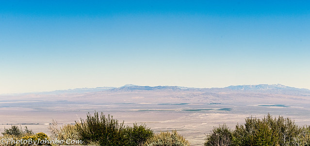
As I noted in last week’s post about the Great Basin Highway, most of Nevada is located in the area defined as the Great Basin. In fact, the basin is actually a series of “basins” that collect what little water that is available in the great southwest. In addition to most of Nevada, the chain of basins extends into Utah, and parts of Idaho, Wyoming, Oregon, and California. The Great Salt Lake is in one of those basins, for example. A complete definition of the geographic, hydrographic, and biologic sectors of the basin can be found on the National Park’s website here.
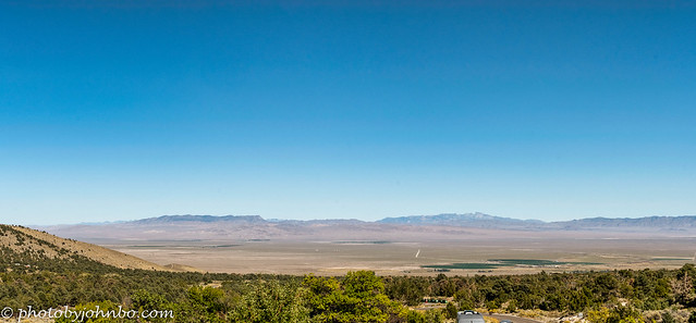
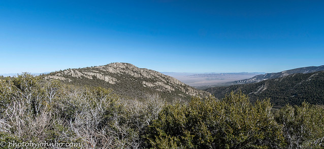
Along the highway that climbs the mountain toward Wheeler Peak, there are several locations where you can get some panoramic views of the basin. This view features part of the highway out of Baker and into the park.

Due to the rapid rise of the terrain in the park, a wide variety of animal species can find ideal environments to support them. The upper level of the mountains gets plenty of snow in the winter. As this post is being written in December, one of the alerts on the Great Basin website notes that the upper levels of the Wheeler Peak Scenic Drive are currently closed due to ice and snow. Check the website frequently for park closure information before starting your trip.
There is no fee to enter the park, but the cave tours range in price from $12 to $15 USD for adults 16 and older. Seniors with a national park pass can get a reduced admission for the holder of the park pass only.
Hikers will find several trails to choose from with difficulty levels from easy to strenuous. The trails are open in the winter, however, they are best navigated with snowshoes or skis. Descriptions of the available hiking trails can be found on the park’s website here.
To view any of these images in 2K HD, click on any of them to navigate to my Flickr site. You can view the entire album which contains additional images captured on our trip to the park here.
John Steiner

Great photos of a wonderful location, John. Love them.
Thanks, Sofia!
Your post makes me want to go back there for another visit!
It is a beautiful place, Hien!
Beautiful scenery.
It is, indeed, Wanda!
My sort of landscape for sure! Like you I would rather drive among the forests and mountains than go underground, however spectacular the cave.
Indeed! Thanks, Sarah.