
Peoria, Arizona.
It’s about an hour’s drive from our house in Buckeye to Lake Pleasant. It’s a long way to go for a typical hike, but it’s such a beautiful location, I usually try to hike the Pipeline Canyon Trail at least once a year. That’s two-miles out, two miles back, and we get to cross a canyon on a floating bridge in the process.
My colleagues, the other leaders in our hiking club, suggested that I should add to the hike, as four miles is a short hike for such a long drive (the hike is almost shorter than the drive.) Point taken. Looking at the trail map, I saw there is a trailhead that adjoins Pipeline Canyon. Yavapai Point Trail crosses a valley and climbs a ridge opposite the trail we normally hike. Climbing in gentle switchbacks on a narrow trail, our journey was rewarded with the views from the top.
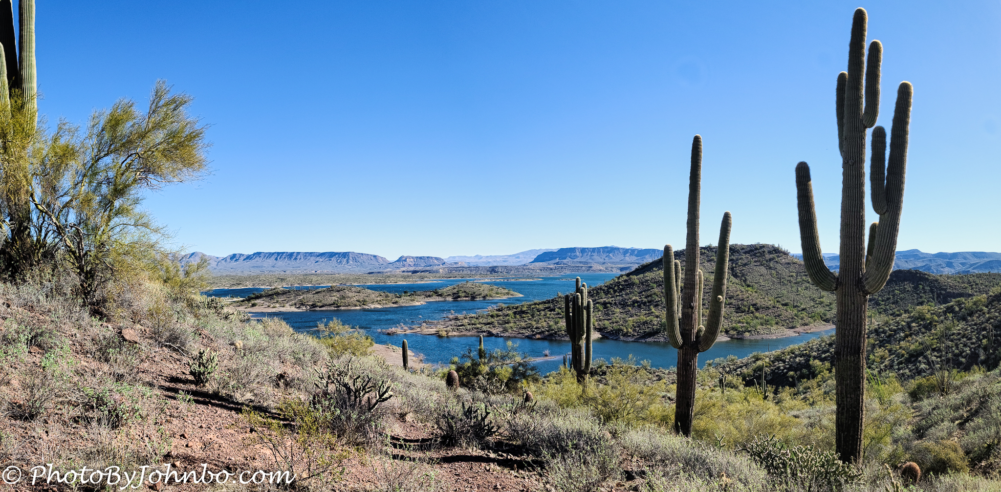
About the photo: Lake Pleasant is a man-made lake on the Agua Fria River. From the top, you can see much of the 7,500-acre reservoir. Looking northeast from the peak, I saw a row of saguaro cacti that directed my eyes toward the reservoir and the many ridges that create a plethora of islands. Using my Samsung S20U, I captured those saguaro and an additional image to the left. Using Adobe Lightroom, I created a single panoramic image and cropped it for the best composition, then finished the project in Luminar AI. While at the top of Yavapai Point, I captured several images as I took time to take in the views. In a future post, I will share some more views from this point. This trail has now replaced Pipeline Canyon as my favorite trail in Lake Pleasant Regional Park.
John Steiner

Cool photo! Does this lake provide most of the water for Phoenix?
Your question prompted a bit of research on my part. What I found out is quite interesting. Lake Pleasant was created by the Waddell Dam built in 1927. However, a series of canals from the Colorado River delivers water to Lake Pleasant as well. A new Waddell Dam was completed in 1994 to store both Agua Fria and Colorado River water, and generate electricity. Along with a series of underground storage aquifers, the combined water resources provide about 2/5th of the Phoenix water supply.
Oh, I miss that landscape. So beautiful.
Indeed it is!
A remarkable image, John. I love how you use these cactus plants as a leading line to the lake, then to the mountains. And, you are lucky to be close to the lake.
Thank you! Interesting how they lined up for me, just as if they were posing for the photo… >grin<
Nice capture. I like the desert and cactus in the foreground and water in the distance.
Thank you! It was nice of those saguaro to stand at attention while I took their photo. >grin<
The juxtaposition between the lake and desert makes for a stunning image!
Thanks!
John I love your picture. Vince and I are going to have to find this trail There are so many beautiful cacti along Highway 17 as we go south towards Scottsdale and there’s never been any time to stop and capture them. This is a beautiful shot. I’m using this post as pingback on your comment for my post on Categories for tomorrow. I see your organization here. It is very organized.
The declining line of the cactus adds a great deal of perspective to the photo, while giving it a distinctive character.
Those saguaro help to identify the place as a desert despite the appearance that there is plenty of water.
[…] John Steiner […]