
![]()
Eloy, AZ
About an hour’s drive south of Phoenix along I-10 eastbound to Tucson, a singular mountain peak rises from the desert floor on the south side of the Interstate. Used by travelers as a landmark for centuries, Picacho Peak rises above the desert floor some 1500 feet (457 meters). One of the few peaks in the area, Picacho Peak is a natural navigation point. In the mid-1800s, a wagon road was constructed and later stage coach traffic carried travelers through Picacho Pass.
Probably the most notable historic event in the area occurred in 1862 when Confederate and Union soldiers skirmished in the Battle of Picacho Pass. The battle was to become the largest clash of the blue and the grey armies in Arizona.
A view of the peak from a little past the halfway point on the Sunset Vista Trail
Our ultimate goal for this trip from Phoenix to Tucson was to hike the Bear Canyon Trail in the Santa Catalina Mountains north of Tucson. Read about that hike here. Picacho Peak lays almost exactly half-way between Phoenix and Tucson, so a short hike on Picacho Peak would be a nice break to stretch our legs.

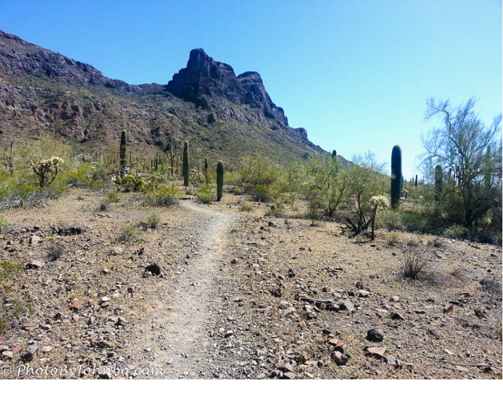
View looking northwest toward Phoenix along the way on the Sunset Vista Trail
We had hoped to make the trip about a week earlier. It was late spring, April 2, to be exact, and we were hoping to see the year’s crop of wildflowers. Had we left that week earlier, maybe those wildflower vistas could have happened. By the first of April, however, wildflower season was over. Picacho Peak has a reputation for a large amount of wildflowers when the winter rains are plentiful. The hillsides become awash with color, mostly gold from the Mexican Poppies that are prolific in the Sonoran Desert. Unfortunately, that collection of wildflower photographs will have to wait for another year.
I was so disappointed; I didn’t even bother to take my good camera along on the hike. This post features the output from my Samsung Galaxy S3 cell phone camera. The opening shot of this post is a panoramic view taken with the S3’s automatic panorama mode. It was then “tweaked” and cleaned up in Photoshop Elements.
The other two images are snapshots taken from the trail leading to the peak. The state park features five trails; three short trails, each less than a mile and two longer trails. We chose to hike Sunset Vista Trail, a total of 3.1 miles. The first two miles are listed in the park guide as moderate difficulty and the last mile is rated as difficult. Some of our group made it to the peak that day, but my wife, Lynn, and I opted to head back at just past the two-mile point, giving us a total of over four miles for the round trip.
Next year, if the wildflower reports are good, we’ll have to make the trek again. I’m told we’ll be glad we did.
John Steiner
