
Kosciusko, Mississippi.
It isn’t often that I need to provide pronunciation guides for the places we visit, but one of our stops on the Natchez Trace requires it. Kosciusko (/ˌkɒsiˈʌskoʊ/ KOSS-ee-USK-oh) Mississippi is one of the few towns located just off the Natchez Trace Parkway. Though the 444-mile (715 km) parkway runs from Natchez to Nashville, we only traveled the route from Canton to Tupelo, about 160 miles (258 km). Well, technically, I need to subtract 12 miles (19 km) or so. Just south of Tupelo, the parkway was closed for road resurfacing.

Though there are towns nearby all along the way, there are no food, gas, or lodging services on the Parkway itself, so be sure to plan ahead and be prepared for short detours to nearby towns for services needed. Our stop at Kosciusco found us at a nice visitor center that featured the history of the town as well as some background on the parkway. A large wall map complete with brochures and information sheets pointed out special stops along the parkway’s entire route.

In addition to its historical sites, the Natchez Trace Parkway also offers a variety of recreational opportunities. Visitors can hike, bike, horseback ride, camp, and fish. There are also several picnic areas and scenic overlooks along the Parkway.

The National Park Service manages three campgrounds along the length of the Parkway. Those campgrounds are Meriwether Lewis at Milepost 385.9, Jeff Busby at Milepost 193.1, and Rocky Springs at Milepost 54. The three Parkway campgrounds are free, primitive, and available on a first-come, first-serve basis. There are also bicycle-only campgrounds as well.

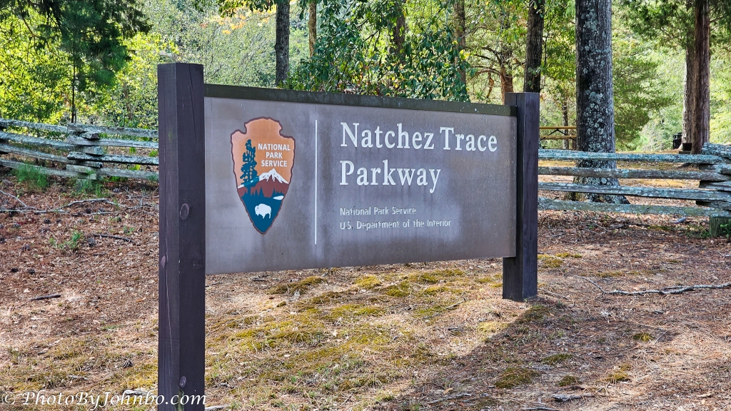
All along the route, points of interest are identified by these signs. There is about a half-mile “warning” sign indicating a potential stopoff is coming up. Some sites have restrooms, but most do not, so plan accordingly.

The parkway roughly follows the path of the original Natchez Trace, a historic travel corridor used by Native Americans, European settlers, and traders for centuries. There are many of these stop-offs along the route, so those who are interested in the entire history of the parkway can expect plenty of time on the road and a multi-day trip.

The best time to visit is during the spring or fall when the weather is mild. Be aware that the Parkway is a two-lane road with no shoulders, so it is important to drive safely and be patient. On the Sunday we visited in early September, we encountered little traffic. We were occasionally passed by vehicles whose occupants were in much too much of a hurry to enjoy the pace of the parkway so be careful not to get “run over” by those who have to “hurry up to see it all.”

Many of the stops are historical references. This sign reads in part, “The Road to your left, running to Canton, Mississippi, was opened in 1834 and named for Choctaw Indian Chief Ofahomo or Red Dog. Like other Choctaw, he had accepted the ways of his European neighbors and had become a farmer.”

When planning your trip, be sure to check the National Park Service website here for any alerts or closures. It was on the NPS site where I discovered the short detour on the highway near Tupelo. The Natchez Trace Parkway is a popular destination for motorists, hikers, bikers, and horseback riders. It offers stunning scenery, abundant wildlife, and a rich history.
In a future post, I will feature one of the stops along the way, Cypress Swamp at milepost 122.0 near Canton, Mississippi. It is home to towering bald cypress and water tupelo trees, which are adapted to living in waterlogged soils. Stay tuned for more about the Natchez Trace Parkway.
John Steiner

What a wonderful and beautiful trip John! I long to discover National Parks away from the East coast. I have become fond of parkways and scenic parkways. The joy of the open road.
It was. Indeed magical and so much more than Interstate whatever. 😉
Something to add to your fact file
Mt Kosciusko is the highest mountain in Australia (2,228 meters (7,310 feet) tall), a hill compared to the rest of the world but then again it has been eroding for around 600million years longer than the rest of the world.
Mount Kosciuszko was named by Polish explorer Paul Strzelecki in 1840 after Polish cultural and political hero Tadeusz Kosciuszko. It is part of the Kosciuszko National Park
Interesting connection to your country and ours, Brian!
I’ve read good things about this parkway but never had the chance to drive it, so enjoyed seeing your images and hearing more about it. And I’m looking forward to seeing the Cypress Swamp too, it sounds very much my sort of place!
You won’t be disappointed!
Thanks for the tour John! After our 2013 cross country tour, my husband said he didn’t want to drive further than to Arizona! I enjoyed seeing something I missed. I’m looking forward to the next installment.
It is a big country, so hard to choose what to include on a trip!
Especially when you’re in your eightieth decade!
Oh wow, years ago we did part of The Trace, have lots of relatives in that state so we would go each year……………one year we did a little different. Thanks for sharing this.
I am glad you enjoyed the post and hope it brought you many pleasant memories.
great tour of the park John, thanks as always for the great information and beautiful pictures. Have a great Thanksgiving!
-Archer
Thanks, you as well, my friend.
I bet the pioneers and others would have loved having this nice road. 🙂 Lovely spot and I would enjoy all the historical information.
Happy Thanksgiving to you both.
Thanks, Janet. It would be a marvel for them.