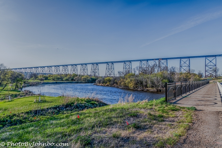
Proud of their reputation as a City of Bridges, Valley City, North Dakota features a tour map at their information center and online here. By far, the most spectacular bridge on the tour is a railroad bridge that not only crosses the Sheyenne River but also spans the entire valley. The bridge was completed in 1908, it’s needed due to the large changes in elevation that trains needed to transition the valley. The 3860-foot (1,180m), span gently lifts trains to the higher terrain on the western edge of Valley City. At its highest point, the bridge rises 162 feet (49 m) above the valley floor.
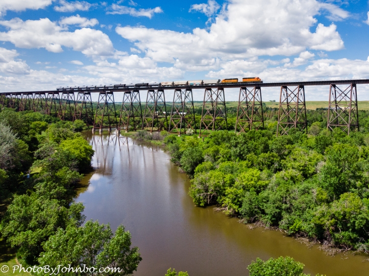
 This view of the bridge looking east is the best image I have showing how the bridge rises on tall tower structures as it spans the valley on the northern edge of the city. The bridge is still a working bridge. The opening image features a Burlington Northern freight train heading eastbound. In my earlier photos of the bridge, I was unable to get a clear view of the span. A few weeks ago, we were in Valley City to check out Medicine Wheel Park, (a future story you will see here), and I decided it would be good to try using the drone to capture some better views of the bridge. Of course, it is not legal to be on railroad property to launch a drone (or for any other reason).
 South of the bridge and on the other side of a bend in the river, there is a public park. Chautauqua Park, from where I could safely and legally launch my drone. From ground level, all the trees of the city block the view of the bridge, but with the drone able to move above the tree line, I was able to capture several images of the bridge that I put together in Adobe Lightroom to provide a complete panorama view of the bridge.
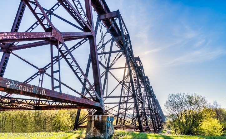
 One of my photos from our previous visit on an early Sunday morning I captured from the edge of the highway that goes underneath the bridge. I was on the legal side of a sign that reminds walkers that the area under the bridge is private property, no trespassing. (OK, I admit to not remembering the exact verbiage on the sign, but I got the idea.)
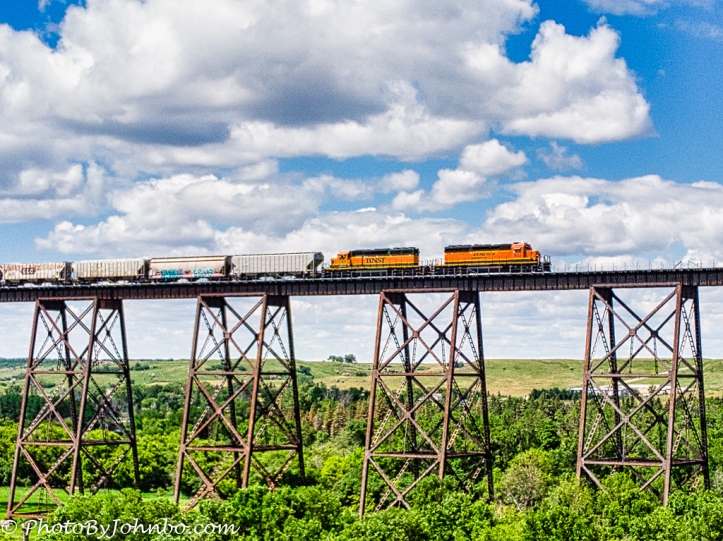
A couple of notes on that opening photo: I am always fearful of letting the drone travel very far away from my position on the ground. Though we were quite some distance from the bridge, the resolution of the camera allowed me to crop the image and still keep the pixel count above the 1024×768 dimension that I consider minimum for sharing here. The image below is the original composition from which I cropped for a closeup view.
 Secondly, I knew that the bridge is still fully operational. Upon launching the drone, I wondered how long I might have to wait before getting the opportunity to see a train on the trestle. As i finished capturing my images for collection into a panorama shot, I heard the sound of a train whistle. Turning the drone and looking to the west on my drone controller’s iPad display, I thought I could see the headlights of a train approaching. I looked at the available battery remaining and saw I still had probably 5 minutes before I would get the 30 percent warning. Given that the drone was right above me, I could push that warning since it would only take a few moments to land.
It turned out that the train was moving fast enough that I got an entire collection of images as it approached and continued to the east. When I landed, I still had more than 30 percent of the battery power remaining. As usual, if your browser supports it, you can click on an image to enlarge it for a better view. I would recommend doing that for a closer look at the large panoramic view of the bridge.
John Steiner


There is just that something with trains that increases the excitement 😀
I find trains to be a fascinating subject. A relative recently sent me a link to a company that provides an experience driving a diesel or steam engine, with or without train. I’d love to do that, but the cost of “tuition” is beyond my budget. >grin<
Yeah, here in Sweden there is still a few steam engines that are doing trips occasionally (a few times a year) I have just never figured out how to join. 😛
Then there are the much smaller museum rail roads that runs along old tracks not in commercial use and they usually have really old trains running. 🙂
I’m envious because I love train trestles. Nice captures, I like the panoramic shot. Would the drone have been allowed there? Do you think you’d have gotten any interesting shots with it?
You may have noticed one image I captured from the base of the trestle. I was on a sidewalk next to a roadway that passed underneath the trestle. That was on public property. What I didn’t note is that I used Luminar to “erase” part of a “No Trespassing” sign that stuck up in the lower left edge of the bridge. The area, except for the passage for pedestrians and roadway, is “off-limits”. I could have launched a drone from public property and flew it outside the railroad’s right of way, and even over the trestle. I opted to shoot with the drone from the park on the other side of the river as from there I was able to capture more of the trestle in a single image than I could from being right next to it.
There are more large trestles on the Burlington Northern tracks that run through the northern United States than I expected there would be, especially in those plains states east of the Rockies where the terrain is relatively flat.
That’s interesting. Thank you.