
Ely, Nevada.
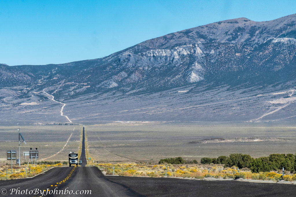
On our western journey in 2021, we left Salt Lake City for the Great Basin National Park in Nevada. We stopped at Ely for the night as that ensured a 90-minute drive or so to the park where we could spend a full day. We traveled on U.S. 50 toward Baker and the entrance to the park. We were to soon learn via signage along the way that we were traveling the Great Basin Highway.

Along the route, there are a few viewpoints to see the mountains that comprise part of the Great Basin. Much of Nevada is part of the Great Basin. “The Great Basin, broadly speaking, is a geographic area between the Sierra Nevada mountains on the west, the Rocky Mountains on the East, the Snake River on the North and the Sonoran/Mojave Deserts to the south. About 95% of the state of Nevada is in the Great Basin.” This quote and much more detail about the area’s geography are found here.

One roadside stop that most interested me is a wayside marker that tells the story of the Pony Express. In addition to the markers, a metal sculpture “cut-out” of a pony express rider is featured. One of the plaques tells the story of the development of the Pony Express that for a time was the only connection between the east and the west for the flow of information.

For those interested in a short history of the Pony Express, I’ve enlarged the text of the above placard in the image below. I find it interesting that the demise of the Pony Express is the result of the invention of the telegraph. (Processing note: I cropped the above image to focus simply on the text in the paragraphs titled “The Crowds Cheered on…” in Luminar Neo and used the new Supersharp AI module to make the resulting text more readable. To see how sharp the text appears in a high-resolution image, load the Flickr version by clicking on the image below.)

Each of the plaques at the way stop referenced Schell Creek Station. When I researched the information for this post, I wanted to note the exact location of the stop so I could reference how far it is from Ely. Well, it turns out that Schell Creek Station is actually north of Ely. We didn’t travel north of Ely on our route, and unfortunately, I didn’t take any cell pics of this way stop, so I couldn’t use the Lat-Long information that is tagged on all of my cell phone pictures.

One of the signs showed a typical ad for employment at the Pony Express for $25 per week in the 1860s.

The Great Basin Highway is much longer than the short section we traveled from Ely to Baker. One source describing the highway suggests a 3 to a 5-day trip to take in all of the sights on the 350 miles (560 km) of the highway. With side trips along the way, 600 miles (960 km) can be within the realm of possibility. You can find out more details on the entire Great Basin Highway route here.
To view the images in 2K HD, check out the entire album here or simply click on any image above.
John Steiner

It such a amazing area, interesting history too. I like the wayside marker .
The Great Basin is truly the epitome of the phrase “Wide open spaces.”
I love the look of that road – everything I expect of a road trip in the US!
My wife and I are so fortunate to have the health and ability to travel in our retirement. We consider ourselves lucky to live in such a varied landscape throughout the country.
That’s a very nice drive! Great Basin is a favorite national park for me.
Before our trip that year, I’d never heard of the park or the scenic byway. It was a wonderful discovery for us as we researched what we could find in Nevada.
Very familiar view! Beautiful!