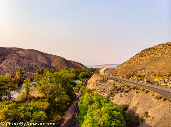
The Yakima Scenic Byway is a popular detour from the Interstate highway system in central Washington state. Highway 821 and the drive through this beautiful river valley will be featured in an upcoming Travel Tuesday here. For now, here’s a teaser, an image from my drone of a section of the valley near the city of Ellensburg.
Throughout the scenic valley, the three common modes of travel since the highway opened all travel through the river valley. The Yakima River is named for the indigenous people who’ve lived in this valley for thousands of years. The first western visitors recorded were the Lewis and Clark Expedition that explored the area in October, 1805.
The railroad came along in the 1880’s, Northern Pacific built tracks through the valley that are still in use today. On our trip, we saw a large collection of railroad construction equipment vehicles traveling north on the tracks.
The highway was built in 1924 as the Yakima Canyon road. Eventually became U.S. Highway 97, and in 1973 was reconstructed and became the scenic highway that parallels the river and the railroad through the valley.
About the photo: On our trip through this beautiful valley, we stopped at several places, a few were appropriate sites for launching the Mavic Air for a birds eye view. This photo is a panorama of two images created in Lightroom. The goal was to show the three modes of transportation in use through the valley over the years. Final touches on the image were completed in Luminar 4. As always, if your browser supports the function, click on the image for a better view.
John Steiner


Wow, great image. You can capture some amazing angles with your drone.
Thanks. That not-quite golden hour timing helped bring out the late afternoon feel of the day.
It’s funny this juxtaposition of means of transport. In the end, people just follow nature.
Truly, the path of least resistance.
A panorama of two images, Wow!! Amazing shot, John!
Thanks!