
Peoria, Arizona.
Over a year ago, I posted a couple of images in Cellpic Sunday posts of views along the Yavapai Point Trail in Lake Pleasant Regional Park. In one of those posts, I recounted the story of my usual trips to Lake Pleasant and my favorite trail in the park, the Pipeline Canyon Trail. The 4-mile (6.4 km) trail was one that I made a point to every year. In February 2021, the other hike leaders suggested that I add something to the hike to make it a bit longer. After studying the park’s trail maps online, as a hike leader, I made the decision to add a side trip from Pipeline Canyon to Yavapai Point and back.

The trailhead for the Yavapai Point Trail is only about 500 meters from the north trailhead of Pipeline Canyon. From there, the trail ventures to the east of Pipeline Canyon and up to the point and back. On the way back, we opted to take a short feeder trail that rejoins Pipeline Canyon Trail a few meters south of the Yavapai Point Trailhead. As it turned out, the Yavapai Point Trail would be the major part of a hike that should have been over 5 miles (8 km).

When we got to the park, we learned that the floating bridge on Pipeline Canyon was out of service. While it is possible to cross the cove without using the bridge if the water level is low, when the reservoir is high, it would be a swim or at least a wade across the cove. We opted to drive to the north end of Pipeline Canyon and make the hike mostly along the Yavapai Point trail. According to MapMyWalk, we hiked only 3.1 miles (5 km) and climbed some 359 feet (109 m) in elevation on the hike.

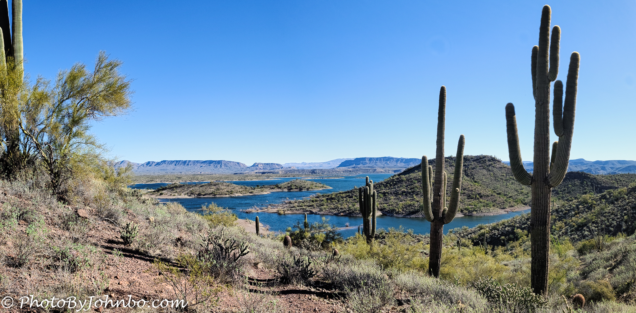
The reward for that climb to the top is expansive views of Lake Pleasant, the source of about 50 percent of the Phoenix metro’s water supply. Hikers won’t find the climb unpleasant, it’s a relatively gentle rise, but be aware that the park hiking map labels the hike as Moderate.
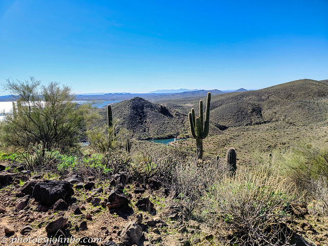
You may recall reading a couple of paragraphs above that the Pipeline Canyon Bridge was closed. From this view, just to the right of the large saguaro with multiple arms, you can see the bridge across the cove is in place and appears to be useable. We considered continuing on with our hike to the other end of Pipeline Canyon and back, but hesitated in that we couldn’t tell from here whether or not the bridge entrances were blocked off.

I used my Samsung S20U to capture all of the images on this trip. Several images were made into panoramic photos via Adobe Lightroom. The image above is a panorama I created a few moments before starting this post. I finished processing in Luminar Neo. The other panoramic image of the lake was created a few months ago finishing the processing in Luminar AI. From those two views, taken from different viewpoints at the highest section of the trail, you can get a sense of the size of Lake Pleasant. This view shows the north end of the lake at the inflow of the Agua Fria River.
As I am finishing this post, I realize that it will be a very long time, if ever, before I make another hike in the Phoenix area. With the sale of our house in Buckeye and our goal to explore other regions of the country for at least the next winter, it’s not likely that I’ll be back to Lake Pleasant for at least a year, anyway. But, who knows… after our exploration, we may determine that the “grass wasn’t any greener” anywhere else in the south in our quest to stay away from those North Dakota winters.
You will find 2K HD views of the images by simply clicking on any of the photos above. Alternatively, you can click here to visit the entire album on my Flickr site.
John Steiner

I have heard of Lake Pleasant, but this is my first time seeing this trail. The lake (also the weather that day) lives up to its name and I like how the cacti were arranged in the first picture too. Wish I can go hiking in the US one day.
Hiking in the desert is one of the great hiking experiences in our country. Thanks for taking the time to stop by and comment!
Beautiful photos. There are definitely some beautiful areas of this country. If you have never visited New England i know you would find some great mountain and lake trails there. But, like North Dakota you wouldn’t want to go in winter.
We are planning a trip to New England in September, both driving and then by cruise ship that goes into Canada. We are hoping to gather some images of those iconic New England fall colors along the way.
Beautiful time to go. I have heard the cruise to Canada is wonderful. We have friends who took it a few years ago.
We are looking forward to our first visits north of Boston to this part of the U.S.
MANY years ago I took a road trip thru New England, up the coast thru New Hampshire, Maine to New Brunswick and around Nova Scotia to Halifax – camping with my then sister-in-law. I will look forward to see your photos.
wonderful views and I love the twisted cactus!
Some of the cacti gain interesting shapes as they age. They are fun to see.
It would have been nice if you had a drone to do some looking around of your trails, and the bridge, before choosing your path. Great photos nevertheless!
It would have been a great viewpoint for launching the drone. I need to get that Mavic Air out and dust it off from a long winter of disuse.
Beautiful images John. Loved that twisted sister!
Thanks, Anne!
The view over Lake Pleasant is amazing, John! The twisted cactus is also different from what I’ve ever seen!
The cactusses make lovely focal points in the vast landscapes. Beautifully composed shots these, John – as per usual – of a beautiful piece of earth.
Thanks for the compliment on composition. The Sonoran Desert is far more beautiful than I imagined.
I think most of us underestimate the beauty the desert holds, until we visit!
Indeed!