

Arco, Idaho.
We traveled along the Peaks to Craters Scenic Byway on our way between Carey and Arco to visit Craters of the Moon National Monument. The story of the byway will be featured in an upcoming Travel Tuesday, however today I focus my lens on probably the most unusual landscape I’ve seen in the United States.
Though the volcanic activities have been relatively quiet, there is still underground seismic activity ongoing that, for now, has closed part of the park. According to the United States Geological Service (USGS), the area around the national monument is one of the youngest volcanic areas in Idaho and is considered the most likely to erupt.
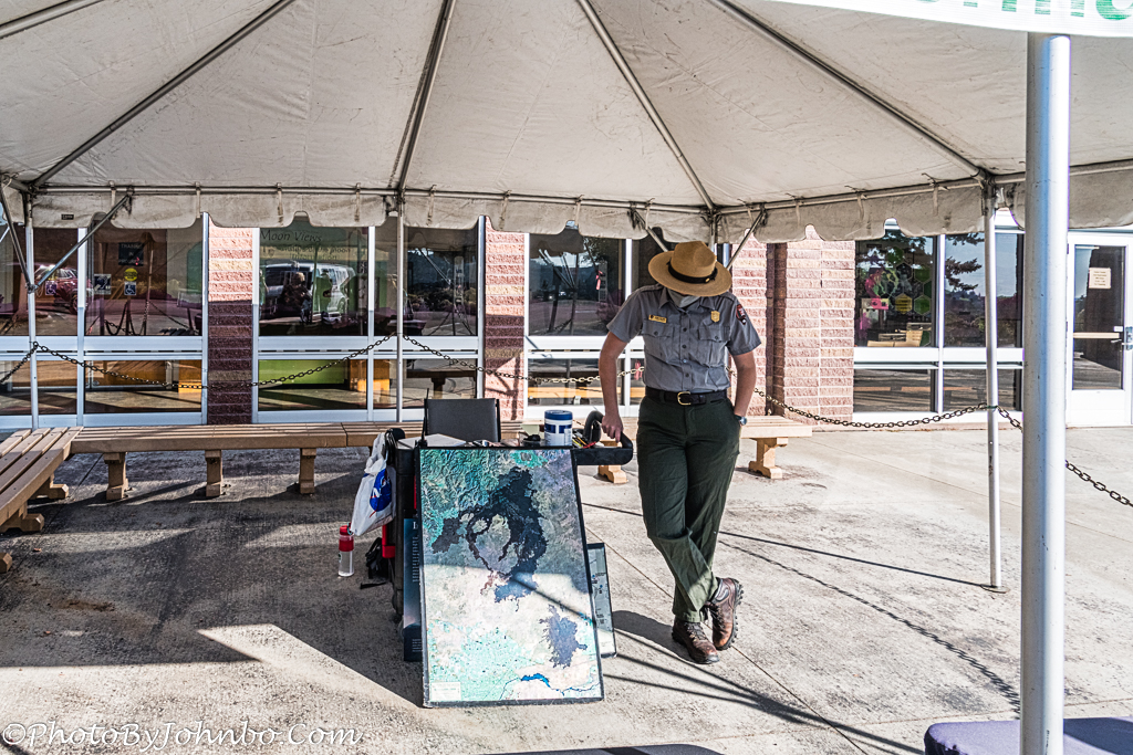
The National Monument is larger than I expected. At the Visitor Center, a ranger described the area using a satellite map image. The 1117 square mile (2893 sq km) park is shown in dark on the map in the photo above. As we visited during the fall of 2020, the pandemic was in full swing. The Visitor Center was closed, but the rangers were available in open areas outside to visit with and ask questions.
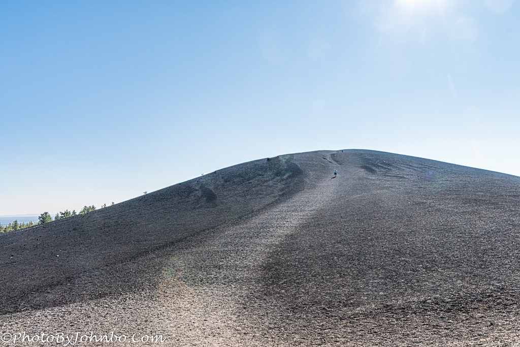
At one location, a huge cinder cone rose high above the general level of the area. If there is a hill, I must climb. Well, from here at the base, it didn’t look that big, so my wife and I started climbing. When we got to about where the person in the photo is walking near the top, we could see that from the base, we couldn’t see the actual peak as the slope changed. What you see in this image is only about two-thirds of the total climb. If you, like me, are older than dirt, plan to take a breather or two on your way to the top.
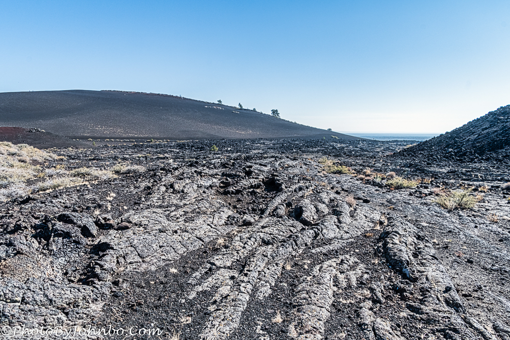
A cinder cone is created during a violent volcanic event. Bits of congealed lava spew from the central vent and fall in a cone shape around the eruption. Cinder cones can be quite tall. This cone is known as Inferno Cone. According to one source, it is unique in that the 6181-foot (185 m) cone is flat on the top and doesn’t have a central vent. Prevailing winds over the spewing vent blew the bits of lava into the huge cone some distance from the actual vent.
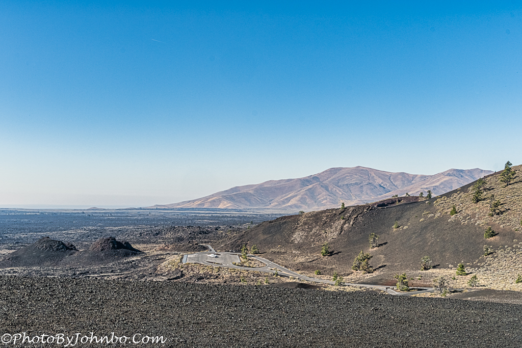
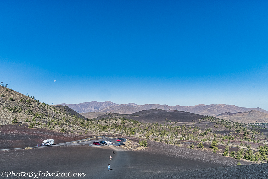
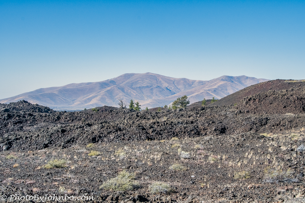
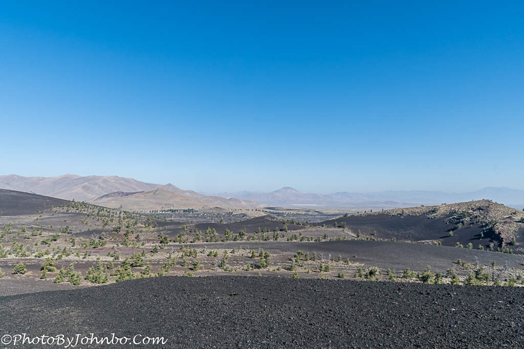
If you decide to hike the short trail to the top, rest assured, you won’t be hiking the 6181 feet from the base. The parking area is only about 185 feet (56 m) below the flat-topped summit. The views from the top of this hill of lava allow you to see the vastness of the volcanic area. Those mountains in the background are on the northwest edge of the lava fields. You can see from here that the fields do indeed cover almost all of that real estate between this point and the mountains. At the conclusion of this post, I will include a gallery of images captured there, including more views from the top of this lava mound. The image below was captured from about half-way up the side of the cone.
We spent the morning at the park which was plenty of time for us to travel the loop road. Hikers may enjoy a trek on one of several trails, each varying in length and difficulty. Due to seismic activity, though, some of the trails have been closed. Check with a park ranger before picking an appropriate hiking trail for more information.
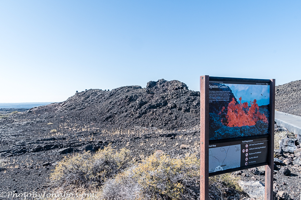
There are 55 volcanic cones and 14 fissures in the park. There are a couple of spatter cones we checked out on our visit. These cones are the result of larger blobs of lava being expelled than the bits that create a cinder cone. The two spatter cones we viewed have paved walkways and a viewing area where you can look directly into the vent that created the cone. I found a source for much detailed information about Craters of the moon that I used in documenting parts of this article. You can read the entire treatise here.
I conclude this journal entry with a gallery of images captured that morning we spent at Craters of the Moon National Monument. As always, I recommend clicking on an image to enlarge it and make it easier to scroll through the collection (if your browser supports the function.)
John Steiner


This could be used for a movie set, eh?
Indeed.
Coincidentally, on our way home from Arizona last week, we went by Grants, New Mexico and saw a similar, but much smaller landscape. There is a volcano near there called Bandera.
This country has such a wide range of terrains.
My main stomping grounds as a kid and one of my very favorite places on the planet.
I grew up in nearby Idaho Falls, and we have photos from the early 1960’s where there is no visible vegetation at all in many of the lava fields. I was stunned to see lots of little plants and grasses growing everywhere when I visited the area about ten years ago.
Another interesting aspect to think about: In the early 1960’s, all of the lava fields there were estimated to be 30,000-years old or older. Still pretty young in geologic terms, but not in human terms. Then they began to get more accurate in their age assessment of the lava, and I’ve noticed with each new decade that the figure has been getting younger and younger – with the most recent dating to be around 1,500-to-2,000 years ago. Now that’s pretty recent!
Interesting to note the changing estimates, no doubt more accurate based upon newer technologies and techniques.
Wow, this is exactly the sort of place I would love to visit! I’m always in awe of your national parks and monuments system and the landscapes it protects, and we never miss a chance to visit them on our US road trips. Your info about the different types of lava reminded me of our visit to El Malpais National Monument near Grants NM – have you ever been there? We only had an afternoon to explore the park which is quite extensive but we managed to see quite a lot.
Coincidentally, we made our first visit to El Malpais only three weeks ago. Part of that area was closed on the day we visited but we saw some of the terrain around there and visited Bandera volcano and the ice cave. We look forward to returning when it is fully open.
When you do get back I recommend the view from Sandstone Bluffs – awesome!
Thanks for the tip!!
Amazing, John! I can just imagine what it would’ve looked like fresh after the eruption, with that vast area covered in boiling and steaming lava and ash!
It would be a sight for sure!
I’ve always wanted to stop there when I visit my sister. So glad you posted photos from there. 😀
It is worth the stop next time you are in the neighborhood.
This makes for a special and different landscape, very entertaining. Thanks for the work.
Truly a unique landscape and a fascinating place to visit.
Thanks for bringing back memories of this amazing place. We visited there when our boys were young. Too bad I wasn’t doing photography then. I remember it as being an eerie landscape. Great images John.
Thanks!! Interesting place for sure.
😊
Hi JOhnbo
Thanks for the tour of this lovely place
And like how you said where there is a hill you will climb – ha
And agree with the tests and breaks of these little hikes
– the cones are so interesting and I like the photo of the ranger near the sign – with the legs crossed and toe down! Great composition