OK, so I took a break from my drone photography this winter. It’s been a busy season for me between Civil Air Patrol activities, nearby travel destinations, and even a Caribbean cruise (just before CoronaVirus, fortunately.) Part of my issue revolved around how to get to a photogenic place in the desert where I could set up the drone. The carrying case I had been using for the Mavic Air is a repurposed video projector bag that once belonged to a long-since broken projector. It wouldn’t be the best way to schlep the drone and accessories on a hike.
Awhile back I was unpacking from our cruise and I came across a small backpack that I’d purchased to carry water and accessories on our cruise ship excursions. Sure enough, the entire drone kit and all accessories, except the safety vest and collapsible landing pad fit nicely into the backpack. A couple of Saturdays ago, Lynn and I set out to find a suitable place to test the process. We picked the Petroglyph Trail near the Buckeye community of Verrado. We found a relatively level and open area just off the trail and I set up the system. Total distance on the hike from the trailhead to the shooting location and back was 2.2 miles (3.5 km).
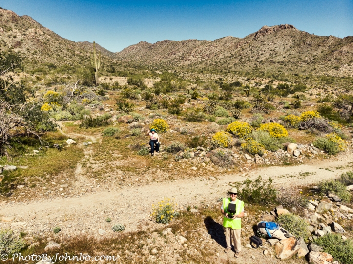
You can see the empty blue backpack on the rock near where I am standing. The dark gray cases carry the drone, batteries, controller, and the other bits and pieces of a hobby that truly is the antithesis of “point and shoot.” My job is to fly the drone, compose images and set exposure using the controller screen and take the photos. Lynn’s job is to watch the drone as I maneuver to ensure that I don’t inadvertently fly into something that I can’t see on my screen. Since the drone can fly in any direction, I often “can’t see where I am going” as I maneuver the drone to capture the best composition.
About the photo: The Mavic Air has a fixed aperture of f/2.8. That is a sensitive lens so on bright days, shutter speeds of 1/4000 or faster are common. This image was captured at 1/2500 sec., ISO-100. After downloading from the drone’s micro-USB card, I cataloged it in Lightroom, made a few basic edits there, and then exported it to Luminar 4 for final processing.
I think I can find a way to temporarily attach the landing pad to the back of the pack so I won’t have to carry it in my hand on the next hike. Some drone pilots might scoff at the use of the pad, but in the loose desert soil, that prop wash from the drone’s four blades would stir up a lot of dust that could easily settle on the lens and “cloud up” the images before I even start.
John


Hi there! 😀
Hi. Hope you and yours are well!
We’re quite alright, locked down as we are in our home, John. I hope you are all doing fine in the midst of the pandemic too?
We are staying close to home, only going to the store as we need supplies. When we get back to North Dakota in a couple of weeks, the Governor of ND has quarantined those coming from states like Arizona. We are bringing supplies with us.
Sounds like you are doing all the right things, John, and we wish you well!
Hi John, trying to get in touch w you via email. Could you send me your address? trschell@me.com . Thanks
Email should be in your mailbox now.