
The road to Oatman, Arizona.
Actually, one of the roads led us through some beautiful country, slowly. First, some background… regular readers followed our trip from Phoenix to Las Vegas via US 93, through Arizona’s Joshua Tree Forest, past Hoover Dam and into Sin City. On our way back, we wanted to take a different route. Looking at Google Maps online presents two viable paths to Oatman from Las Vegas. The shorter trip is via US 95 through Searchlight and Laughlin down to Fort Mohave. But I didn’t check Google Maps once we were on our way. Apparently that was our mistake, or fortunate happenstance, depending upon your disposition.
While on the road, I usually use two GPS units, a Garmin Nuvi that has lifetime updates and the in-car navigation (minus regular updates) of the Toyota Avalon that is our usual ride. Using one to check the other’s route gives me comfort that I am picking the best route. But things can go awry.
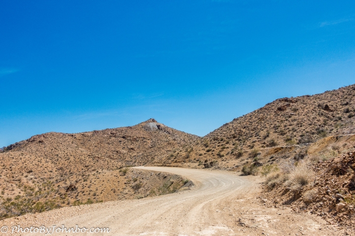
As we were nearing Laughlin, Google Maps would have told us to go south, staying west of the Colorado River. My two GPS units, however, had us stay on an easterly course directly to Laughlin, crossing the Colorado River there. We crossed into Arizona on AZ State Highway 95 and were instructed by both GPS units to turn onto Silver Creek Road. It showed 17 miles (27 km) or so, if I recall correctly. Looking out the window, I could only see a wide expanse of gravel road. The GPS units also showed about 40 minutes to our destination… something that gave me a bit of pause. Right at the junction is a large lot full of cars with trailers. There were many people milling about unloading their off-road vehicles from their trailers and obviously preparing to trek across the desert country… something that gave me more reason to pause.
We stopped, I got out of the car and walked up to a small group of people who were unloading their off-road buggy and asked, “Is this the road to Oatman?” I’m sure they could hear the concern in my voice. One of the young men in the group said encouragingly, “Yes. It’s less than 20 miles and the road eventually joins Route 66 just outside of Oatman. It will probably take you about 45 minutes. The road is good, it’s just winding. It will be fine for your vehicle.”
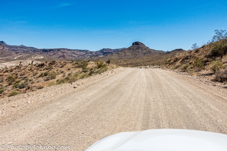
Indeed, the road was fine, though there were some sections that were recently graded and quite smooth, there were areas with some washboarding that slowed us down. The photo above is a shot captured through the open sunroof. As you can see by the two images, the road is mostly in great condition and plenty wide. But it is not well traveled. I remember only meeting maybe three cars heading westbound toward Laughlin. It certainly was the road less traveled as Robert Frost might have noted. Had we followed Google Maps, we’d have spent about the same amount of time between Laughlin and Oatman, but we’d have stayed on paved roads, traveled much further and moved faster. But we’d have missed this experience. I’m not recommending the trip on the gravel, but if you prefer the road less traveled, it’s clearly an option. The paved highway is Arizona State Highway 153 and runs into old Route 66 as the Oatman-Topock Highway. Just outside of Oatman we turned onto Route 66 just a mile or so from the town.
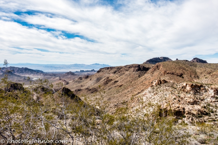
For the story of Oatman and our visit, check the link below to view last week’s post. This week, it’s all about the journey. Leaving Oatman, the scenery along Old Route 66 is typical southwestern desert as you can see from the image above. This view is of the Black Mountains of Mohave County. 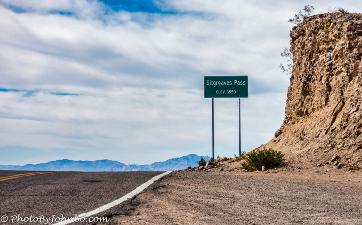
It’s a short climb to a gap in the mountains known as Sitgreaves Pass at an elevation of 3,586 ft (1093 m). The Black Mountain Range runs east of the Colorado River, at its widest about 15 miles (24 km) east of the river in Mohave County, Arizona. Sitgreaves Pass separates the northern and southern sections of the range. The mountains aren’t particularly tall with Mount Perkins topping the list at 5,456 feet (1,663 m) in elevation.
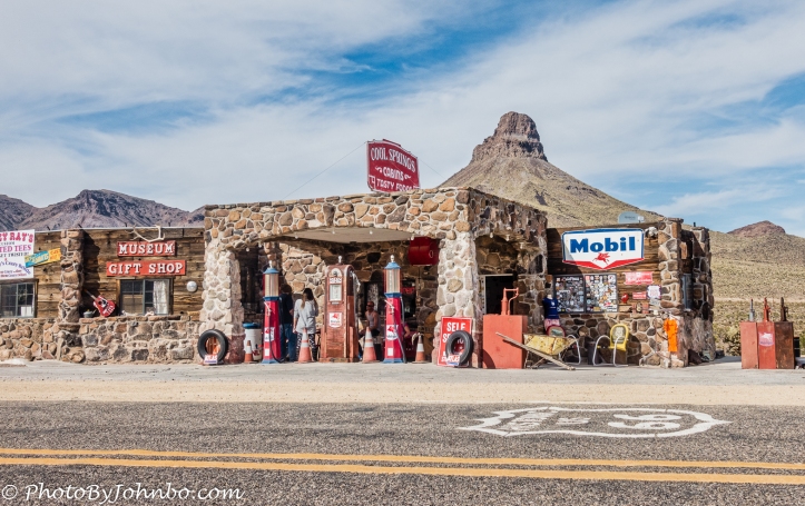
A short distance from Sitgreaves Pass, you will find Cool Springs Station. Were we travelling this route in the last decade of the last century, we’d have passed the remains of an old gas station. In 2001, Cool Springs Station was purchased by a new owner and today, Cool Springs Station is now a museum and gift shop. On some trip in the future, we may stop and enjoy lunch at a replica Cool Springs Cafe that is yet to be built. The gallery of images below features high resolution versions of the photos. In most browsers you can select an image to enlarge it and to scroll through the gallery.


John Steiner

Beautiful shots. I am glad you took the alternate road!
Thanks!
Nice. I will revisit this post when we return. Some friends told me about this. Looks like we would even HAVE to have the jeep, but it would be nice. Thanks for this great info John.
I’d guess there are some great four-wheeler trails around there, though with our sedan, we stuck to the gravel road.
What a great scenic drive! Sooo happy you didn’t miss this. Way to take the road less traveled.