
 San Juan del Sur, Nicaragua.
Our excursion to Nicaragua’s most active volcano began with a 76-mile (122 km) bus ride to the Volcano Masaya National Park only about 15 miles (25 km) from the capital city of Managua. We were late getting there due to a 30-minute stop for traffic, a pilgrimage of the faithful Catholics that I will share with you in a couple of weeks. That delay and subsequent smaller delays would ultimately get us back to the ship late. Fortunately since the tour is an NCL excursion, the ship waited for us.
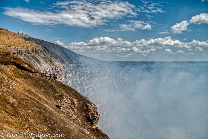
But I digress… Masaya National Park features a road that leads to a viewing area where just feet from the parking area, you can step off the bus and moments later find yourself looking into one of the main calderas. The opening photo features a view of the volcano captured from along the roadway on our way back to the ship. The lateness of our return precluded the promised side trip to a more photogenic viewing area.

As we approached the caldera viewing area, we could see a lava flow that spewed from the volcano’s earlier eruptions. The last eruptions spewed ash in April, June, August, and December 2008. That December, the ash cloud rose to over 3 miles (5 km) above the volcano. The last explosion was on April 23, 2001. Visitors to the crater rim on that day were surprised by the sudden volcanic explosion and two people were injured. Though we were given rudimentary safety instructions on what to do if the volcano were to erupt while we were there, I don’t think our tour bus would be very much of a safe zone from a really angry volcano.
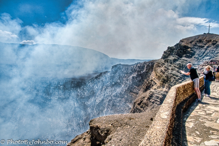
I was actually quite surprised to be dropped off so closely to the edge of an active volcano. The atmosphere is thick with sulfur gases emitting from the opening. As you can see in the photo above, the winds were pushing the sulfur cloud toward the viewing area. Where I was standing, I could smell it, but I was getting mostly fresh air. Looking into the photo on the extreme right is a higher vantage viewpoint that I tried to use. Unfortunately the sulfur cloud precluded me from standing there as each breath brought a fresh load of sulfur into my lungs. I didn’t stay long enough to get that treasured viewpoint photo.
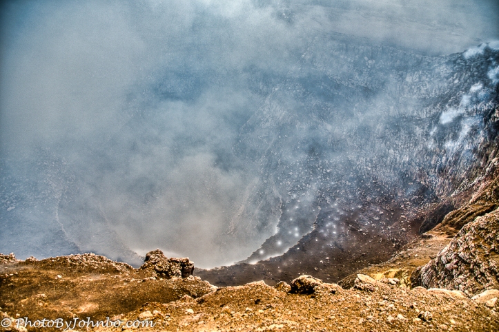
The view from the crater’s edge were up close and apart from the rising cloud of sulfur, quite photogenic. Over the years lava lakes and red glows have been visible but according to a history of the volcano’s recent activities, that lake slowly cooled and crusted over in the mid-1990’s. For those more interested in the volcano’s geologic history, check out the article here.
 On the day we visited, workmen were either repairing or installing a giant cross on the nearby peak. From this shot, you can see the viewing area that I had to move away from earlier. The sulfur cloud didn’t drive everyone away from the vantage point, but I’m sure it didn’t do anyone’s lungs any good while they were standing there.
 The National Park had a small line of visitors in cars that were also visiting the park that day. The drive from the park entrance doesn’t take long and the entire visit to the volcano rim was less than 30 minutes. From this stop, we would travel to the small town of Catarina where there is a viewpoint of Apoyo Lagoon, a volcanic crater lake about 30 minutes from the national park. More on that part of the excursion next week.
John Steiner

Magnificent views!
This stop was one of my favorites in the entire cruise.
Thank you for sharing, John!
What a fascinating geological experience, John!
I suspect that here in the United States, we wouldn’t be allowed to come that close to an active volcano. 😀😀
Too many selfie-posing teenagers would be fried to a crisp I suspect! 😀
Indeed! >grin<
What vivid views, never seen an active volcano… Thanks for the opportunity! I bet they make amazing wines in that region.
Interesting thought… about the wines. Maybe some research is in order.