Toutle, Washington.
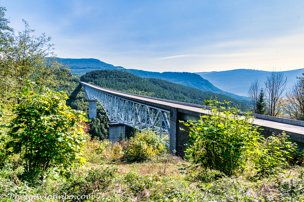
The best access to the blast area defined by the eruption of Mount Saint Helens is via State Route 504, also known as the Spirit Lake Highway. Built to replace the original highway destroyed by the eruption, this 52-mile (84 km) highway contains 14 bridges that span the valleys west of the mountain. The tallest bridge on the highway spans a deep valley where some 370 feet (113 m) below, Hoffstadt Creek winds its way west toward the Toutle River.
In the early 1990s, a $200 million USD project created the highway that leads to the mountain from I-5, exit 49 at Castle Rock. To cross the valley, a bridge with a 600-foot (183 m) span opened in 1991. Building the bridge high created a safety zone from flooding of the river now far below. The deck truss bridge cost $12.6 million USD and its height makes it second only to the High Steel Bridge over Vance Creek in the Olympic National Forest. The Hoffstadt Creek Bridge is the third tallest bridge in the northwestern United States.
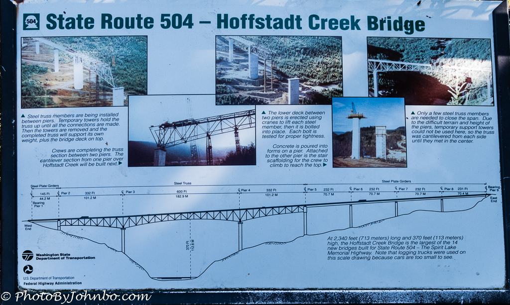
Just west of the bridge is a turnoff that you can take to a bridge viewpoint. The two images of the bridge featured here were captured at that viewpoint. At the site, there are several placards that provide facts about the bridge and the surrounding forest. The image above is the placard that describes in text and photos the construction details of the bridge project.
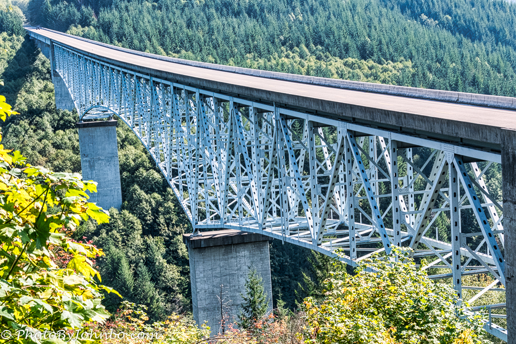
The closeup above provides more detail of the piers and truss system on the bridge. The deck is 32 feet (9.7 m) wide and 2340 feet (713 m) long. To help you gauge that distance in the image, notice the tiny automobile at the far left (east) end of the bridge.
The views are spectacular when traveling across the bridge, but for those who have issues with high places, you may want to avoid looking out the side windows or let someone else drive.

When I looked up the location of the bridge in Google Maps, I discovered that there is a street view image set crossing the bridge. You can “drive” across the bridge in either direction and check out the 360-degree views of the valley. Click on the image above to load Google Maps in your browser and check it out.
John Steiner

Wow, John – what a feat of engineering, and as aesthetically pleasing as it is functional.
I don’t have a fear of heights for myself, but when a family member goes near a severe drop I can’t bare to look!
I have a couple of family members who are really bothered by bridges. If they have to cross a high bridge, they won’t drive, and insist on being able to not look outside at all.
Fears like that would really get in the way of my wanderlust!
Mine as well.
[…] Hoffstadt Creek Bridge – Second Highest Bridge in Washington State — Journeys with Johnbo […]