
 Chinle, Arizona.
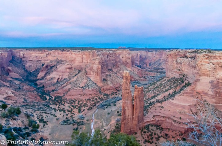
If you are traveling east or westbound on I-40 between Arizona and New Mexico, plan to spend at least a morning or afternoon exploring Tseyi, the Native American name for the collection of canyons of Canyon De Chelly National Monument. The view in the opening photo features Spider Rock, a view often found in Hollywood westerns.
For I-40 travelers, a detour to the canyon will cost less than four-hours fuel for your vehicle, and a bit more for driving between the overlooks along the two scenic drives. Add a stop for refreshment in the city of Chinle, and lots of water. There is no park admission fee, and even the hiking along the White House Trail is free. Expect to pay a fee, however, for back country tours whether by hiking, vehicle or horseback, you are required to hire a Navajo guide.
The canyon, as you can see by the park service map below, resembles the letter V laying on its side. Two roads parallel the canyon, the road from Chinle is Indian Route 7 which passes the visitor center and then travels east and south along the southern segment of the canyon. Near the visitor center, Indian Route 64 branches north and east along the northern segment of the canyon.
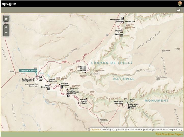
Though the National Park Service website suggests two hours for each leg of the trip, that can be a bit optimistic, especially if you like to spend some time taking photos or simply enjoying the magnificent views. Taking them at their word, we arrived in early afternoon, and ended up missing a couple of the last scenic overlooks as we wanted to be at Spider Rock Overlook for sunset light. There are three overlooks along the north drive, seven overlooks on the south drive. Many of the overlooks have relatively long access roads, so my recommendation would be to spend the morning traveling the northerly road, have a leisurely lunch and spend the afternoon traveling the southerly route.
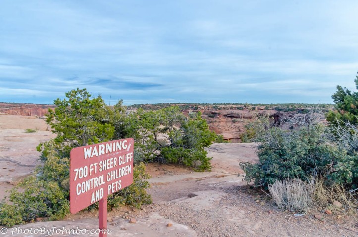 Though some of the viewpoints have fenced overlooks, most do not. Warning signs like the one in the photo below can be found, but I found myself looking down from the edges of sheer cliffs at many locations where no warning signs exist. Yes, that dropoff in the image above is a sheer cliff. Keep a close eye on your younger family members and keep pets leashed wherever you are at the canyon viewpoints.
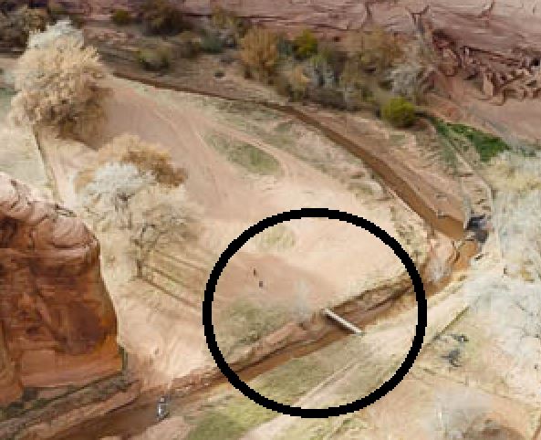
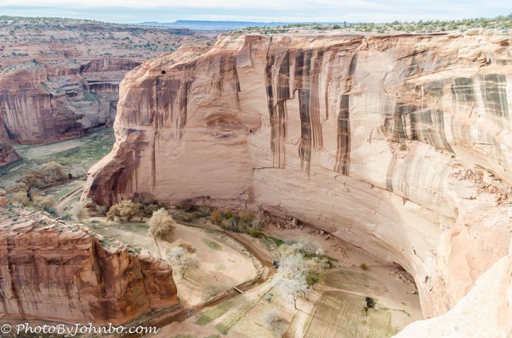 Though much smaller than Arizona’s Grand Canyon, this canyon is no slouch when it comes to sheer size. To help you gauge the depth of the canyon, this image of the river and farmland should help. Notice the bridge crossing the river in the lower center of the image above. Below, I captured a small section of the above image and zoomed in, circling the bridge area. In the zoomed in section of the image, inside the circle, you will see two people walking away from the bridge.
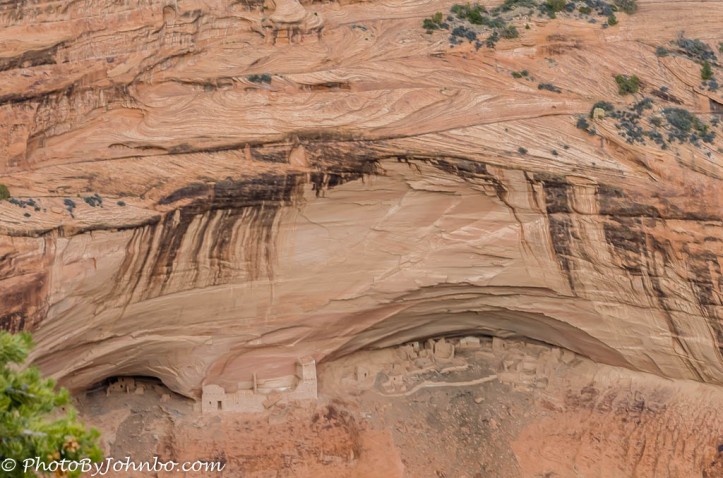
People have lived in the canyon for over 5,000 years. At several overlooks, views of ancient dwellings like the pueblo at Mummy cave below are easily viewed, especially with the help of a long lens.
There is so much to see at Canyon de Chelly, I elected to feature two posts, today’s post, (with the exception of Spider Rock in the opening photo), features views from the north side of the canyon. Next week I will share a gallery of images taken from the south.


John Steiner

Looks beautiful! Thanks for this.
Thanks for stopping by and following. Stick around for next week’s views of the southern route through the canyon!
Wow! Superb photos and looks like an amazing place too 🙂
In Many respects, I find it more spectacular than the Grand Canyon. Thanks for stopping by.
Gorgeous! You’ve done a beautiful mash up on one hand these look the desert in loony tunes, but if you look closely there’s green everywhere. Deserts are cool.
Deserts show the tenacity of life. Plants can grow in the most amazing places. Minimal soil, minimal water… no matter. I AM HERE!