

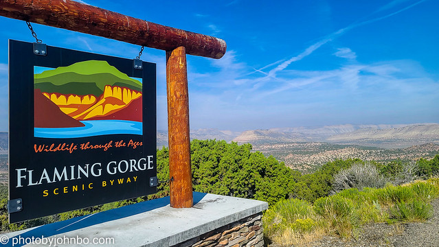
Flaming Gorge National Recreation Area.
Starting at Vernal Utah, we drove northerly on US Highway 191 and then onto Utah Highway 44 turning off 191 to go by Red Canyon and then along the west side of the gorge, some 70 miles (112 km) or so. Most of the views in this gallery are from this drive, however, I’d also recommend staying on 191 toward Dutch John and then into Wyoming. Then backtrack to highway 44 to finish your journey on the byway. You’ll get to cross over the dam and reservoir near Dutch John and can take a look at the eastern side of the gorge from Wyoming. Admittedly, the view of the gorge is from quite a distance, but the terrain there is entirely different than on the west side where there are views of the Ashley National Forest. That side trip will add maybe 40 minutes or so to your trip unless you spend extra time at the visitor center.

At a way stop just north of the Wyoming border, you will find this view of a grassy plain and a large enough parking area to turn around to head back to the west and continue on the scenic byway. There is a large visitor center at the dam which we didn’t get to see as it was Sunday in Utah, and the facility was closed for the day.

Along the byway, you’ll find some beautiful country, but the number of pull-offs is lacking. It’s not completely the fault of the highway designers. There are some narrow roadways with little space to provide pull-offs from the highway. Passengers can enjoy the views, but be nice to your driver and let him or her take a turn as passenger. So backtrack a little and give the driver a break.
I don’t mean to imply that the road is one of those high, winding mountain roads that are difficult for some drivers and passengers. The road is plenty wide and far enough from cliff edges, there just isn’t much room for pull-offs to enjoy the views. One of the most interesting features of the highway is the state’s inclusion of signage that describes the geographic history of the region.

There are several interpretive sites and four nature trails to explore along the way. Technically, the scenic drive ends at Manila, but take that “T” to the right toward Wyoming and State Highway 530 which goes all the way to Green River and Interstate 80. The highway parallels the gorge and the Green River for several miles. From there, you can head west to Salt Lake City or east to Medicine Bow, Wyoming.

OK, I’m not usually one to feature what are not views of the natural environments on my posts. I found, however, the scenic viewpoint directing us to a higher elevation to contain this large plant where some kind of mining operation is going on. Compare the size of those large vehicles with the cars in the parking lot.

Specific details about the scenic drive and a small map can be found here or more information on the highway is available here. I have many more images on my Flickr site where you can pixel-peep at the entire collection here.
John Steiner

For cool 😎 We used to get permits there in the 80’s to harvest Quake Aspen trees which sold and planted in Park City building development areas made thousands 💲 😉
Interesting.
I am enjoying your views of America John 🙂
Thanks, Brian. I’ve been enjoying the travel and capturing the images to share.
Truly amazing, John.
This part of the western U.S. deserves more exploration with my camera. It’s just beautiful.
Indeed. And then share with us, it’s been wonderful.
Fascinating area with great photos!
Thanks, Hien!
Fabtastic views John! I always look for these scenic byways when planning a US road trip but have never driven this one – it looks great!
We’ve made it a point to seek out the scenic byways in our travels. Oftentimes, they have the advantage of being “the road less traveled” as Robert Frost might say about them.
Great pics as always, JS. Of course when I see “Uintas” I really see “Unitas.”
Unitas… so do I! 😀
Thanks for taking us there. Great images!
Thanks, Amy!