Grants, New Mexico.
On our way to and from Arizona, we navigate through Grants, New Mexico twice in most years. It’s been a decade since I’ve been making this trip and it was not until Spring 2021 until I learned about New Mexico’s fire and ice attraction.
Upon entering the parking area, you’ll notice a trading post/gift shop/museum. Stop there to pay the fee to visit the two attractions. You can choose from either or both as the fee covers the admission to the trail that leads to the volcanic caldera and if you take the other fork, the ice cave. On our visit, we chose to take the trail to the ice cave and save the volcano visit for another time.
The venues close for the winter, and as of this writing in November 2021, their website tells me they open on March 1. I’ve scheduled this post to publish on March 8, so they should be open, but I’d check their website here before making the trip to be sure they aren’t delayed due to weather or other reason.
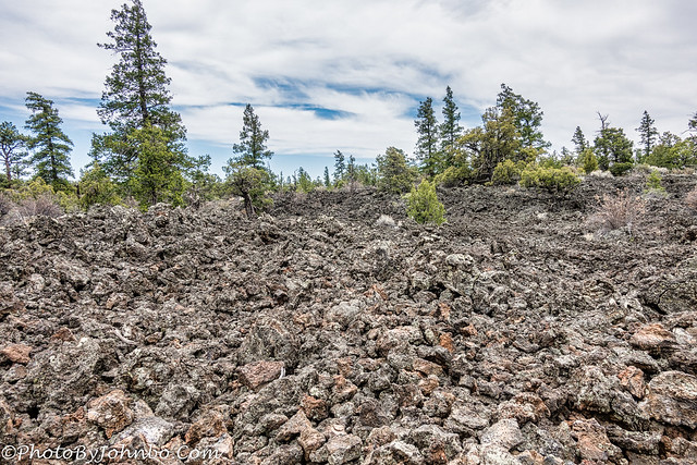
On a chilly day in April when we visited, it was mostly cloudy, and we brought light jackets knowing that the ice cave never warms above 31 degrees (0 C) and those jackets were necessary to fend off the light, cool breeze that we felt. On our walk to the cave, we passed several fields of lava that reminded us greatly of Craters of the Moon National Monument.
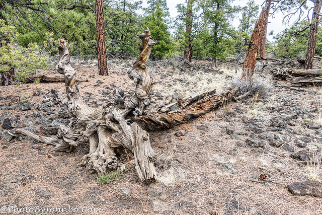
One thing we didn’t notice at the site of the Idaho park was a large number of twisted trees, some, like the one in the image above twisted out of the ground, others twisted in place but still standing. On the trail to the ice cave, there were plenty of examples.
The trail to the ice cave is short, maybe a 10-minute walk, or a little more if you stop to take photos or just marvel at the mixture of plant life and volcanic landscape.
The ice cave is part of a collapsed lava tube, the remnants of which you can also see in sections along the trail. Some 10,000 years ago, Bandero erupted leaving a 23-mile (37 km) river of lava that eventually cooled and now covers the area.
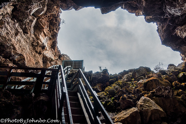
The ice cave is deeper underground than I expected. There are several flights of stairs that will get you to the bottom of the cave. It’s an easy climb down, but coming back up, not so much. Be careful, though. When these steps were built, they weren’t all built to the same depth. Some steps are taller than others. Be sure to use the handrails and expect each step to be potentially different from the one you just navigated.
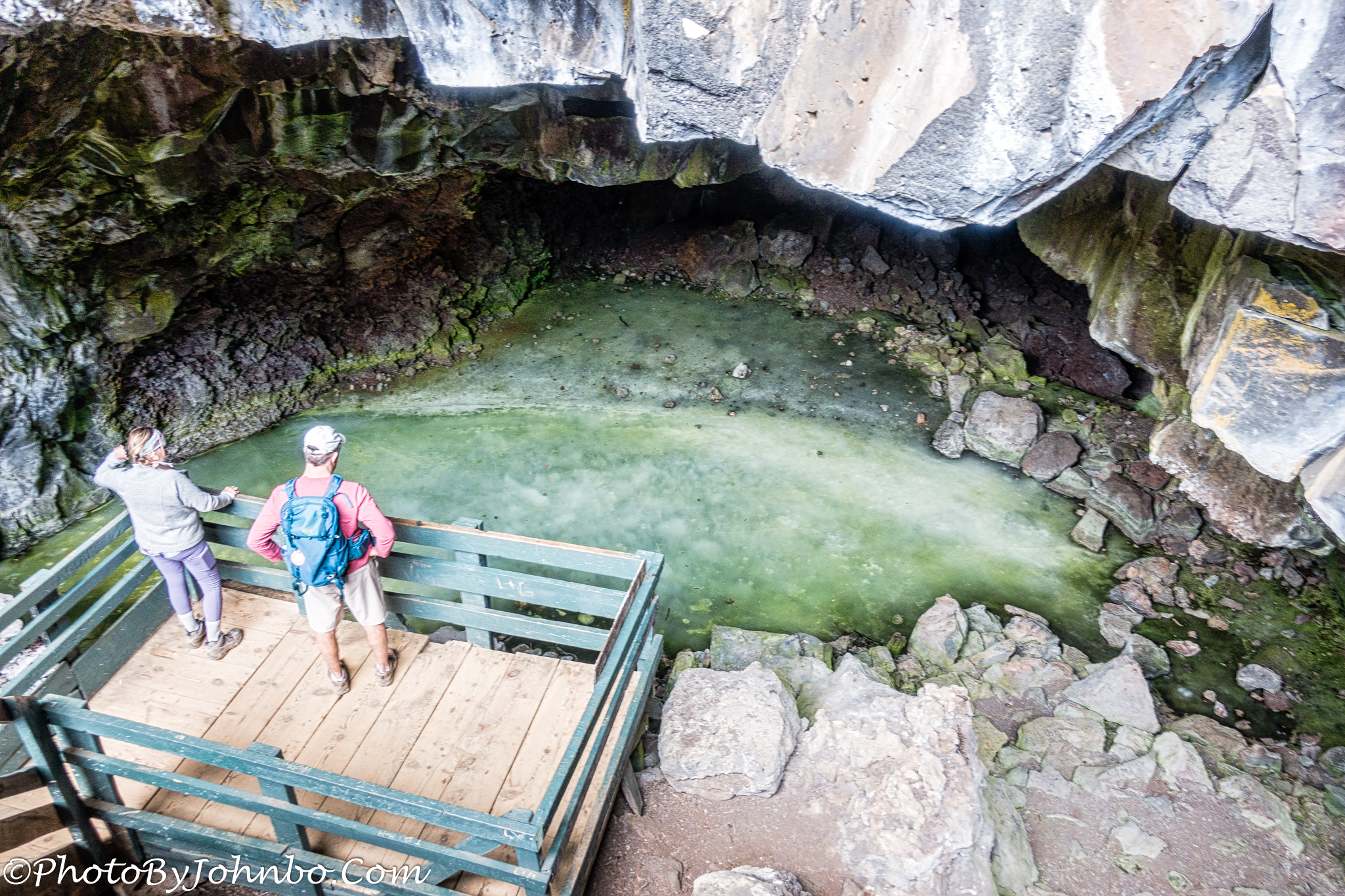
A younger couple preceded our group down the stairs, and though I did get images of the ice cave all by itself, I elected to leave the views of that couple in the image to help you gauge the size of the pool of ice that has grown in depth for over 3400 years.
Looking up from the bottom of the steps, it only looks like a couple of landings, but the stairs “flattens out” a bit and, if I recall correctly, there are two more landings that aren’t visible from here.
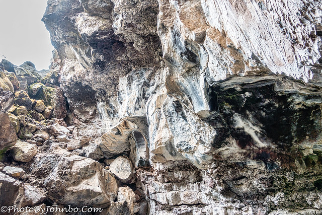
The cave walls are as interesting as the pool of ice with fascinating colorations that I couldn’t help but take several images. I picked one to share that featured the most colorful section of rock.
Climbing out of the cave, the rock walls lighten, I suspect because the sun illuminates this area and over the years the color of the walls has been bleached white. The shape of the cave entrance provides a natural trap for rainwater and snow melt to enter the cave where it freezes and adds another layer to the top of the ice pool.
Leaving the cave, we walked back on the trail to the trading post. This view of the trail leads toward the ice cave. Their website linked above also has a download for a trifold brochure that acts as a trail guide for your self-guided tour. Numbers on signs along the trail correspond to numbered paragraphs on the guide. You will also receive a copy of the guide as you begin your short hike to the cave and volcano.
John Steiner





What a cool place! I’ll be adding this to the itinerary for our upcoming NM trip.
Cool in more ways than one. >grin< I'm sure you will enjoy the visit.
Ha! Pun was not intended.
Thanks for the tour and your beautiful photography John.
Thank you for coming along on our journeys!
😊
This looks interesting – I wasn’t aware of it when we visited that area, unfortunately
We drive by twice a year and didn’t discover it until last year, as well.
Looks like a paradise for people fascinated by geology and natural features!
It is geologically interesting, for sure!