Fargo, North Dakota.
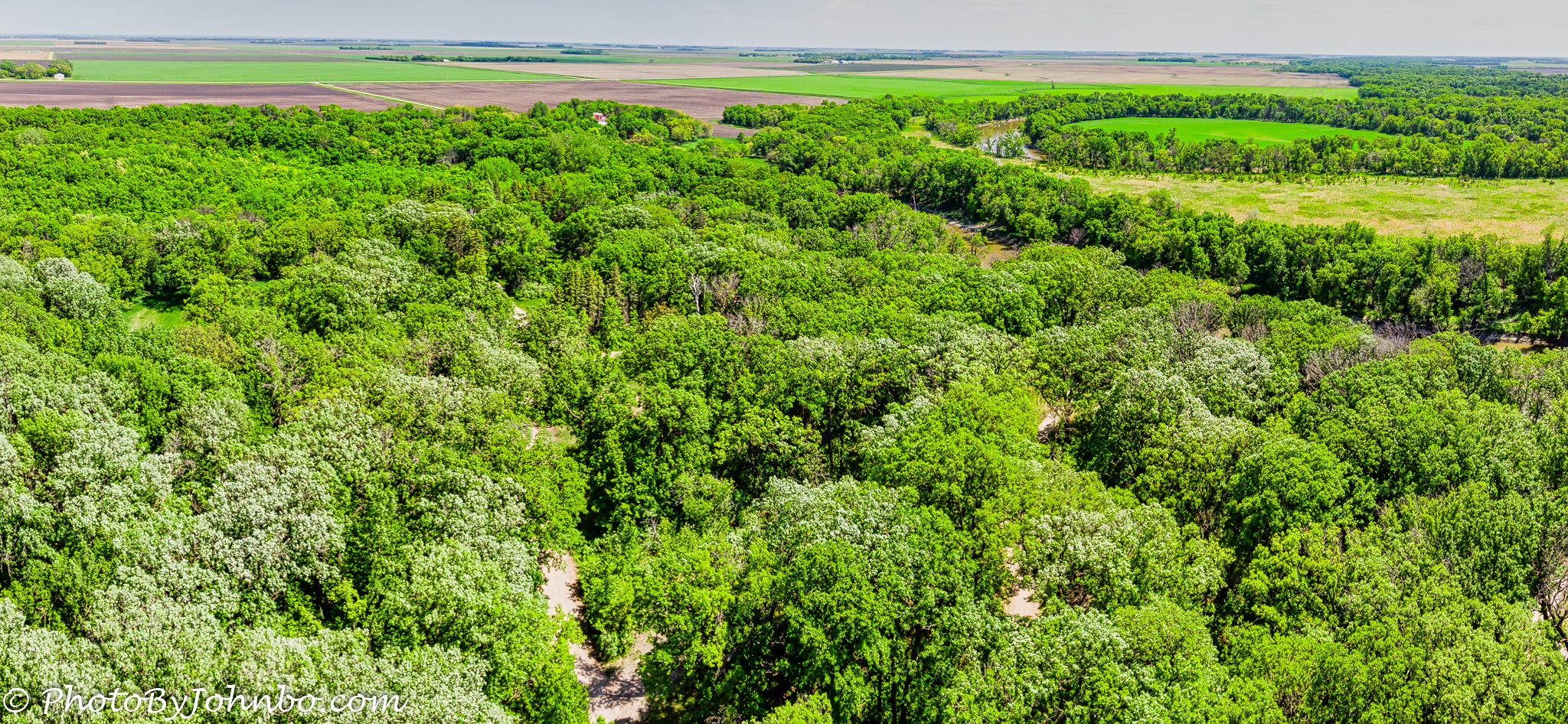
A couple of weeks ago, a friend of ours mentioned Orchard Glen Park in the extreme south of Fargo along the Red River. What we learned upon our first visit is that if we headed further south and then east to the Red River, we would find another park known as Forest River Park. The two parks are less than a mile apart and we’ve discovered they are a popular place for people to explore and bird watch. Situated at an “oxbow” in the river, Forest River Park is about 2000 ft (609 m) by 900 ft (274 m), with the main trail and several smaller trails wandering through the trees. If you look carefully toward the top center of the photo, you’ll see a large house with a red and white roof visible just below the edge of the trees. That house is on the other side of the Red River in Minnesota, the river marking the north, east, and south borders of the park. If your browser allows it, you may have to select the photo to enlarge it for a closer view of the house.
I’d brought my Mavic Air drone in the hopes of getting some aerial shots of Orchard Glen Park, but as it was graduation for the nearby Davies High School, there was a large group of graduates in caps and gowns, as well as families gathering in the parking lot. It appeared they were getting ready for some photos. We headed toward Forest River Park and found it relatively empty except for a few tent campers and dog walkers.
About the photo: I found on that day that the park is a lot bigger than it looks from the ground, though, of course, you can’t really tell the park borders until you see the river, we walked one of the trails until we found a clearing where I launched the drone. The view of the park is a composite of two images stitched into a pano in Lightroom. The drone is pointed slightly to the south of east. From there, the image was exported to Luminar Flex for final touches. I chose a manual exposure at 1/640 sec, f/2.8, ISO-100. The Mavic Air drone does not have an adjustable aperture so I can only adjust shutter speed and ISO. I usually keep ISO at 100 for the best noise reduction, so the manual mode is pretty easy to set, simply tweak shutter speed for best view on the controller monitor screen.
John Steiner


Great pic as always, John. How difficult is it to acquire an FAA license to use an outdoor drone?
The license is known as a Part 107 Certificate. For those who already have a pilots license, the process is very easy, an online course and exam on the specifics of drone operations and regulations. For non-pilots, it’s a matter of learning information about airspace rules and other principles that are already known by pilots. Self-study and an FAA knowledge test at an FAA site are required. Online sources suggest 30-45 days of study and scheduling to get an exam appointment slot. Of course, dedicated learners can cut the time frame down drastically.
Thanks, sir.
Amazing, and a little sad, to compare the natural v man-altered pockets of land in your beautiful image, John. Imagine what this piece of the world would have looked like if we weren’t on the scene.
Indeed. Thanks for stopping by and commenting.