It’s been over a year since I purchased the Mavic Air drone. For private pilots like myself, it is very easy to add the FAA license for Part 107 (commercial drone operations) to my rating, and the North Dakota Wing of the Civil Air Patrol (CAP) is one of the leaders in drone operations for CAP. I wanted to be involved but had never flown a drone before. Knowing that a drone would add to my camera collection and provide a fresh perspective to my photoshoots, I decided to buy my own for both training and photography purposes. I haven’t used it nearly as much as I expected, but some of that lack of use can be attributed to the pandemic. In any case, after a year’s operational experience, I thought it might be time to share (and reshare) some of the images captured both during training and on my travels. The opening photo was captured during a late afternoon practice flight. The long shadows and golden tones give away the late afternoon time frame. 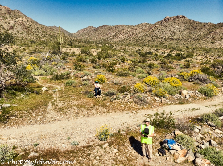 Drone operations are safest and best accomplished with two people, the pilot and a visual observer. When on my photoshoots, my wife, Lynn, is my visual observer. She is also in charge of the logbook that notes details of the flights that aren’t automatically captured in the drone software’s automatic flight log. The image above captures a typical operational scenario. I can safely operate the drone, look at the iPad I use to control and capture images and Lynn watches the drone itself providing an advance warning if I happen to be nearing any obstructions like tall trees or other potential hazards that I can’t notice through the drone’s camera.
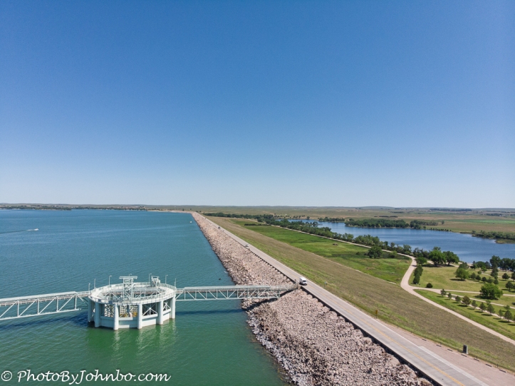
Having a drone adds a different dimension to my blog posts. One example is this shot of Kingsley Dam on Lake McConaughy. It’s a perspective of the road across the dam that I couldn’t have provided any other way. When using a drone in public spaces, it is imperative to confirm that drone operations are allowed in that area. As a Part 107 license holder, I know of several types of facilities and specific instances that are expressly prohibited. For example, any flights over the top of people who are not part of the drone operations are strictly prohibited. For this shot, the drone was launched from a public parking lot and moved a short distance to the vantage point where I captured the image. Previous to launching the drone, I asked at the information center if drone operations were allowed from the shore and got a positive answer as long as I kept my distance from the dam’s operational facilities.
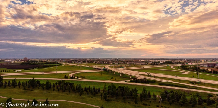 One of my favorite sunset “dronie shots” was captured late in the day at Fargo’s Woodbury Park. Launching the drone from there and looking westerly provides a view of the I-29/I-94 interchange in south Fargo. I started out using automatic exposure, however, it didn’t take me long to switch to manual control of exposure settings. The drone’s camera has a fixed f/2.8 lens with no ability to change aperture settings. That leaves me with only two adjustments to worry about during manual exposure, ISO, and shutter speed. Unless there is very low light (not likely since I’m not authorized for night operations,) I leave ISO set at 100 for minimum image noise. That gives me only the shutter speed to control. Since the iPad on the controller always displays the view directly from the camera lens, I can easily see how changing the exposure setting affects any image that I capture. If the scene is too bright for the desired shutter speed, I have a collection of neutral density filters that I can put on the lens to give me the option of a slower shutter speed for whatever effect I might want to accomplish. I soon learned that the filters are most useful for video and I seldom use them for my still images.
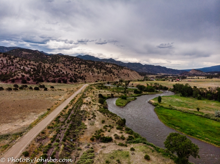 In southern Colorado, the Arkansas River begins its 1460 mile (2350 km) trek from near Leadville, to the Mississippi River north of Arkansas City, Arkansas. This shot of the river was captured where it parallels a railroad track and roadway near Howard, Colorado. This image was captured at 132 ft (40 m) above the ground. Unless otherwise limited by location, the maximum altitude allowed by the FAA is 400 ft (121 m). I seldom fly above 100 feet (30 m) as that’s well above any nearby trees and ground details get quite small.
 Another image from Howard Colorado features a view of the Rocky Mountains. This view is “alternative reality” as the sky was completely overcast that day. I used the sky replacement tool in Luminar 4 to provide some blue sky to brighten the image.
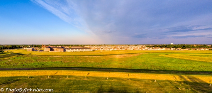
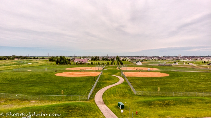 Another practice session in Rendezvous Park allowed me to capture this panorama of the four baseball fields and the surrounding community of West Fargo. Though the drone will create jpeg panoramas automatically, I prefer to take multiple images in RAW (dng) format and stitch them together in Adobe Lightroom. RAW images provide much more data for the photo processing software to work with during those post-processing sessions.
 For those interested, there is a lot of “kit” to drone flying. For some time I used the cases that came with the drone’s “Fly More” kit, but eventually bought a small backpack to hold the gear. That’s made my life much simpler. The zippered pouch on top contains charger gear for the batteries and controller, spare propellers, and a handful of cables and smaller accessories. The covered section on the upper left hides the propeller blade guards. On the upper right, the iPod tripod and controller mount that allows me to hold the controller and iPad as an assembly. The controller collapses into a small package and is stored in the lower left compartment. The drone is in the lower center compartment. I normally keep it in its original case, inside this case for extra protection. On the lower right are three extra batteries, lens wipes, and lens ND filters. That black circular case on the right is strapped to the side of the backpack and contains a collapsable landing pad that I use if I want to launch and retrieve from gravel or tall grass surfaces. Inside the case cover, a pouch holds the iPad, a sunshade to shield the iPad during use, and the paper logbook that Lynn uses to log specifics like battery charge cycles, time of day, location notes, and other items not tracked by the drone software.
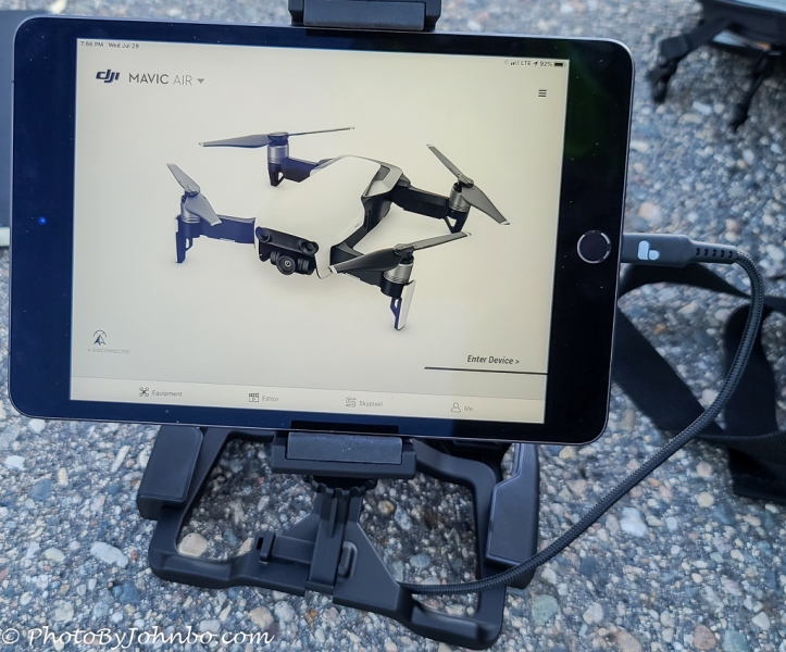 During a recent outing, I took a shot of the controller assembly to share. The clamp-like affair at the bottom is meant to hold a cell phone for a visual view from the drone camera. For those who prefer a larger display, companies have developed display mounts that allow the pilot to attach a larger display. In my case, that’s an iPad Mini. Behind the iPad, the pilot operates the controller “blind”. The image pictured on the screen is the Mavic Air that I use. I like its small size as it’s easy to travel with. The larger drones can stay airborne longer due to bigger, heavier batteries, and they are a more stable platform in higher winds, but they are more hassle to travel with. The 13 minutes average flight time (until I start getting low battery warnings at 30 percent remaining) is plenty of time to get the aerial shots I need. The 30 percent remaining battery life is usually more than enough time to return to the launch location for landing. I seldom have the drone more than 100 feet (30 m) from its original point of launch. Most of the time, I use two of my four batteries to complete a shoot.
It’s a nice day, not at all windy, and it looks like a good day to go out and practice. I have a location that I will be featuring in an upcoming blog post, and it will be a good day to capture those aerial images.
John Steiner
How fun! I think we are going to see a lot more of drone photography in the future. Great photos!
I am slowly integrating these into my work flow. It takes some extra effort, but in certain situations, drone images are the only way to tell some stories. Thanks for stopping by and commenting.
Yes, they show a new angle to a story.
This is really intersting John. I think many of us think that you just send the drone up, like it’s easy. There is so much to this.
It’s truly laying a whole different skill set on top of the normal skills of photography. One of the reasons I don’t take advantage of drone videos is a relative lack of experience generating videos of any kind. >grin<
Wow!
Beautiful shots, John! Cher xo
Thank you!
Nice images John.
I have thought of buying one myself but will hold off for the moment.
Just carry on using my camera.
It’s a challenge to get started from no experience, but not so much as to be overburdening. Knowing where and when you can fly will keep you out of trouble. The legalities of doing commercial photography create a heavier burden. Not to discourage you, but to inform.