This week it’s Amy’s challenge and she’s provided a fun challenge topic for me. She writes, “We hope you will join us by sharing your cloudscapes over land, sea, or cities, or just clouds.” You can read her entire challenge post here.
I managed to capture an incredibly expansive panoramic view of a storm front advancing toward Fort Peck Lake in Montana. Unfortunately, I didn’t have my Nikon camera with me at the time, so I had to rely on my Samsung S20U. Utilizing the camera at hand, I quickly took two shots and later merged them together using Lightroom’s Panorama stitching feature. It wasn’t very long after I captured the images and the rain reached my location. By then, I was inside.
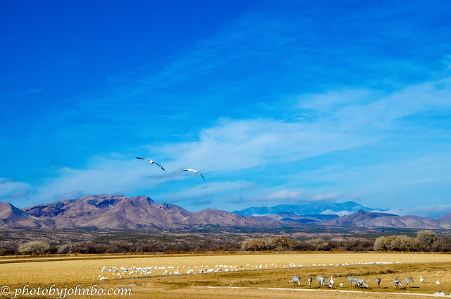
In January 2015 we traveled to New Mexico’s premier wildlife refuge, the Bosque del Apache. In November each year, thousands of sandhill cranes and Canadian snow geese stop over on their migration south. In this photo, there was but a small sample of the number of birds we saw there on our visit. What I like most about this photo, is the vast expanse of sky and the mountain range in the background.
In June of 2013, a lightning strike ignited a fire near Yarnell in Arizona. The fire burned some 8,400 acres (34 km2) and lasted 12 days before it was extinguished. On June 30, while fighting the fire, 19 of the 20 members of the Granite Mountain Hotshots died when the fire overran their position. The movie, “Only the Brave”, released in 2017 tells the story of the firefighters from Prescott and the tragedy of Yarnell Hill. This image was a sunset sky captured near Yarnell.
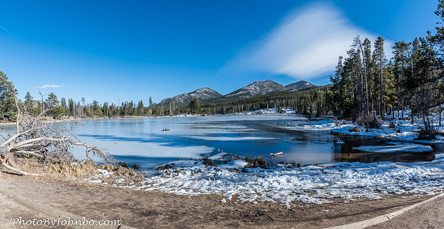
Sprague Lake in Rocky Mountain National Park is a popular destination even in winter. This photo was captured in early November on a cool day after one of the first snowfalls of the season. I was interested in that unusual cloud formation. Clouds aren’t usually square or rectangles at the base and that struck me as unusual. I believe this cloud formation is a lenticular cloud, though that style is usually circular at the base. I think prevailing winds created the squared corners.
One characteristic about clouds I learned when getting involved in towing and flying gliders is the concept of cloud streets. On those days that are best for gliding and for staying aloft for long periods of time, the clouds develop in clusters of puffy cumulus form. If you look at the bases of the clouds, you can see that they can run in continuous lines that glider pilots call cloud streets. The image above captured clearly two rows of cloud streets. Glider pilots will find lift underneath each cumulus cloud, circle and climb almost to the base of the cloud and then glide to the next cloud to repeat the cycle. These streets can run for hundreds of miles when the conditions are right. Cloud streets have intersections, but I’ve never seen a roundabout, a 4-way stop, or a traffic light. The record glider flight in miles in North Dakota is about 184 miles (297 km).
Despite living over 45 years within 160 miles (267 km) of the Canadian border, we have spent more time in Mexico than we have in Canada. Part of the reason for that is our love of cruising and the fact that both of our children decided to get married, they chose destination weddings in Mexico, one in Mazatlán, the other in Ixtapa. While walking along the Malecón I captured a beautiful sunset near Mazatlán’s Golden Zone area.
As we departed Puntarenas, Costa Rica on our way to Panama and a canal crossing, I captured the sunset. If you’re wondering how I could capture a sunset over terrain when looking west on the Pacific Ocean, I wondered that as well. Puntarenas is in a protected cove called the Gulf of Nicoya. There are several islands and a peninsula that extends westward from the coastal mainland. The best way to see what I mean is to use Google Maps and search for Puntarenas, Costa Rica.
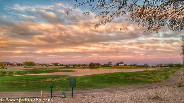
I would be remiss in not featuring at least one Buckeye Arizona sunset. After all, I have many beautiful sunset images from our decade of spending winters in Buckeye. This view is looking east. The sunset was nice looking west, but the clouds in the east captured the warm colors that were reflected in the water hazard below. Sometimes it is best to look behind you to capture the best sunset images.
OK, so I had to feature two sunsets from Buckeye. Just be happy I didn’t post my entire album. >grin< This view is from the edge of the highway leading to Skyline Park.
At the end of a day of gliding, I captured this image of the windsock at Casselton Airport where the North Dakota Wing’s Glider is kept when it’s not being used by a nearby state’s wing. I decided to add drama to the sky by converting the image to black-and-white but emphasizing the windsock by keeping its bright orange color.
Disclaimer: There were no skies replaced in the processing of these images. I certify they are all representations of the skies that were visible on the day I took the photo. Thanks to Amy for this week’s challenge theme. Skyscapes are one of my favorite subjects. I decided to stop at ten images though I could have found so many more to share. To pixel-peep the images in HD, you can find the album on my Flickr site here. Next week, Anne will host the challenge which will be available on Saturday at noon Eastern time.
Finally, thank you to the many people who commented and shared their images focusing on my Art in the Park theme. I thoroughly enjoyed looking at everyone’s take on the challenge. If you’ve been thinking about submitting a challenge-response but have questions, check here.
John Steiner


These are gorgeous, the one from New Mexico and the one from Sprague Lake, especially.
Thanks, Dawn! That New Mexico sky was one of the first HDR images that I really thought turned out well.
It really did.
Fabulous, John. A great collection. I didn’t know about cloud streets! Great information.
Thanks, Patti!
Ooh, you have some wonderful skies here John! Favourites include the first one at Fort Peck (the panorama stitch is very effective), the lenticular cloud over Sprague Lake (I love how the shape of the cloud echos the mountains beneath it) and the Puntarenas sunset. We stayed on the west coast of the Nicoya Peninsula and passed Puntarenas on our way back to San Jose, so I understand the topography you describe 🙂
Thanks, Sarah! I suspect that winds above the cloud and over those mountains were what created that cloud. It is most unusual and so interesting.
Beautiful set of cloudscape photos, John! Love the blue sky in NM. Fort Peck Lake capture, wow! Buckeye Sunset scene is amazing.
“Only the Brave” is a great movie!
Thanks, Amy! This is truly a fun challenge!
Interesting to hear of the cloud streets. When we were in Utah last week I notices many of those cloud formations. To me it appeared someone sliced the clouds all along the bottom. I am glad to know pilots know how to use them. Sprague Lake is always a pretty stop. Never been there, but I know you have posted a variety of the years encouraging us to put it on the list. Your Buckeye photos are fantastic, and I can appreciate your limiting yourself. lol. There could easily be a blog titled Arizona sunsets and it would be spectacular.And Yarnell…. The skies always feel spiritual there, don’t they. I remember that day so well.
It is interesting that clouds have “floors” below which they won’t go. As a layman, I understand that the level at which they start, the dew point temperature won’t hold moisture and it condenses into clouds.
The photo near Yarnell was taken very close to the Shrine of Saint Joseph. It is truly a spiritual place.
oh, yes….we stumbled across that when we were wandering around. It is funny and I imagine purposeful not to find a lot of information about it. It is truly spiritual. Thanks for a great post John.
The Malecón view in Mazatlán Mexico is so beautiful, as all the photos in South America seem, the skies look different there.
I know what you mean, Nicole. Thanks!
Your post has an amazing assortment of clouds and their formations. I also appreciated your instruction. I truly loved them all.
Thanks, Anne! I have so many, it was hard to choose. >grin<
😊
Interesting comment about these being actual skies John – so many folks are using sky replace these days. And now P/S is beta testing a capability that will pretty much let you replace anything you want with anything you want. One of these days we’ll have no idea what’s real and what’s not!! Anyway, great post, glorious skies and I enjoyed all of the interesting factoids that went with them – especially the cloud streets 😊
I just watched a video about the beta testing of that P?S tool and how it creates AI images for insertion into a photo. I am afraid I won’t ever be so competent with P/S as to make it real useful to me. >grin<
Love them all!
The panoramic shot is definitely amazing. I’m looking forward to capture some more this monsoon season.
Rest of your sky photos are beautiful as well 🙂
Thanks, Hammad. It was a stunning storm.
I found myself imagining the experience of being under those skies within the collection of photos. Thank you
They each have special memories for me of the time and conditions of the moments!
It is so hard to pick a favorite for this week. I think the windsock is winning, but since I just posted my black and white, that might be why. These are marvelous skyscapes 😀
Thanks, Cee! I am a big fan of Black-and-white. I’ll have to check your post out!
The first was my favorite, John. Drama in the skies!
I am glad you like it. The storm was scary looking and the photo, I think, conveyed that feeling to me.
Fabulous gallery John with information, some of which I had not heard before 🙂
Thanks, Brian, I’m glad you like it!
GREAT photos John. Real beauties.
Thank you, John!
The right sky can be all you need for a great photo. Cloud streets. That’s a great name for it. I guess you’ve been to Mexico a lot more than to Canada for the weather. It’s nice to go to the tropics. Nice set of photos.
You are right, Dan. It seems my trips to Mexico have a high correlation with cold weather in the northern part of the United States. >grin<
In NYC, too. In winter is when people fly to Cancun.
John, you’ve given us a gorgeous skycape collection. I love the one from Recife, Brazil. I was at that same location about 3 years ago. You brought back some good memories.
Not knowing anything about Brazil before our trip, I only was aware of São Paulo and Rio de Janeiro. I was surprised to see how large Recife is. It’s the 9th largest city in the country according to Wikipedia.
The lenticular cloud over Sprague Lake was spectacular, and I agree with Sarah – I love how the shape of the cloud echos the mountains beneath it. Sundance in colours and the windsock also really spoke to me. Beautiful gallery, John.
Thanks, Ann-Christine. That lenticular cloud was a very lucky catch.