 Washington D.C.
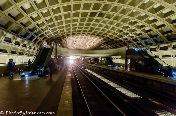
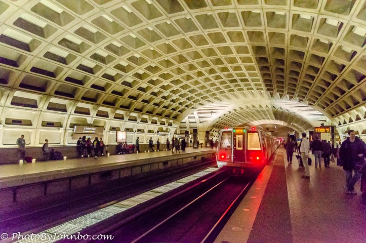
Technically, our trip to Washington D.C. was really a trip to Arlington, Virginia where our hotel and our conference was located, specifically the Crystal City Marriott Hotel. Our work on Thursday, however, was to meet with the legislators for our respective states. Fortunately, a short walk from our hotel through an underground mall brought us to the Crystal City Metro stop.
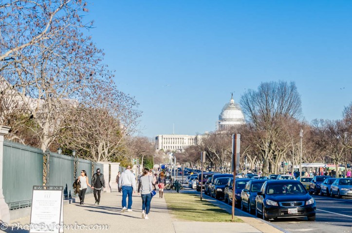 The Capitol Building, as you might be able to note in the photo above, is having its dome refurbished. We would be near the Capitol for our meetings in the offices of our senators and representatives. The metro would take us to within a block of our appointments, or we could step off at a different stop and ride the escalator to street level and enjoy a walk amid the sights and sounds of our nation’s capital city.
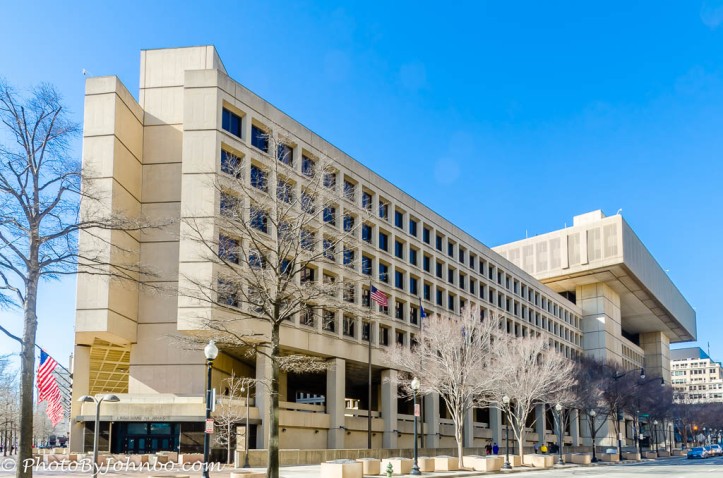
On Sunday, after our work was completed, my wife, Lynn, and I spent the day doing some sightseeing. We rode the metro downtown to visit some historical places, a couple of museums and generally enjoy the sunny February Sunday. There are so many buildings that have familiar names. The J. Edgar Hoover FBI building pictured above is but one example.
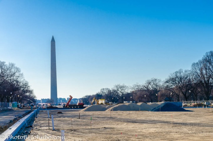
On our way to the one Smithsonian museum we would visit, we walked by the National Mall. It’s completely torn up for a several month renovation. Anchored at one end of the mall is the Washington Monument. Having been to some of the other museums along the mall, this trip we would visit the Museum of Natural History. Earlier, we’d also been to Ford’s Theatre and the International Spy museum, so we found ourselves “museumed out” a little earlier than normal. After only a couple of hours wandering through the exhibits at the Natural History Museum, we headed outdoors again. It was getting late and we needed to grab the metro for our ride home. Fortunately, our walk to the metro station was short and we made it a bit shorter by cutting through the sculpture garden.
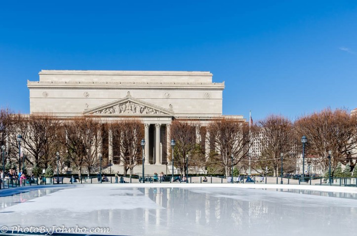 The garden, which is part of the National Museum of Art, has a public ice skating rink as its centerpiece. In the shadow of the National Archives Building, the rink was quite busy the day of our visit. The photo above gives the impression it’s not being used, however as we walked by, the Zamboni was busy resurfacing the rink so skaters all were waiting on the sidelines for fresh ice to resume their skating.
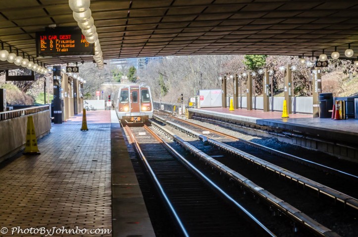
The Metrorail subway consists of six lines identified by color. There are 91 stations located throughout Washington D.C., Virginia, and Maryland. Most tourist attractions are within a couple of blocks of a Metro stop and the Metrorail System Map identifies station names and general location within the system. There are three hub stations at or near the downtown core, Metro Center, Gallery Place and L’enfant Plaza. If you’re not sure where the closest Metro station is, grab a taxi to the nearest station or hub. If you’d rather walk, visit one of the many venues that provide free maps of the city. All of the metro stations are identified on all of the maps I saw. Not all stations are underground, as can be seen in this view of Arlington Cemetery Station above.
Here is one more tip about travelling the metro to keep in mind. The lines are named by their color, Red, Blue, Yellow, etc. Each color line is identified by it’s endpoint stop. For example, the Blue Line travels between Franconia and Largo. You will need to know the end stop in your direction of travel so you can descend on the correct escalator that puts you on the landing with the train heading toward your direction of travel. For example, departing from the Crystal City stop, we wanted to travel to L’Enfant Plaza. We would have to descend to the landing on the side of the trains going to Largo. At L’Enfant Plaza, we used the opposite escalators to descend to the ramp on the side of the trains going to Franconia. It sounds way more complicated than it really is. Grab a map from one of the metro station stands and visit with one of the station attendants if you have any questions.
You can purchase daily or weekly Metro smart cards, or you can load a smart card with a few dollars and ride until the card won’t let you exit because there isn’t enough on the card to cover your trip. Be sure to have cash or a credit card handy in the event you run out of funds on your card. There are machines nearby where you can load more funds onto the card so you can exit the turnstiles.
You can hang onto your smart card for your next trip and you can go online before you get to Washington D.C. to determine how much is left on your card. You can even add funds to the card so it will be ready to use when you get to our nation’s capital city.
The gallery of images below features views of some of the sights on our walk around the National Mall. Click on an image to enlarge it and to scroll through the gallery.


John Steiner

Cool pics! We’ve been to DC but only in the summer, it’s cool to see it in winter! Also took the subway in NY to Grand Central, it was crazy seeing a place, we’ve seen soooo many times in movies.
NY is on my list for someday. We’ll see when someday happens.