
On the day of publication, Lynn and I are in North Carolina this week visiting family. Our son and his wife live in a semi-rural area with minimal Internet service. Their cell phone coverage for our carrier is weak so my usual remote hot spot connection isn’t reliable. Please expect a delay in my responses to your comments We will be home again on June 1.
Lukeville, Arizona.
At the Arizona/Sonoyta Mexico border, a small town (these days less than 40 population) sits near the border crossing known as the Lukeville crossing. On the day of our visit, the crossing wasn’t busy, and I included a shot (from a respectful distance) of the crossing, being sure not to include anything that might get me into trouble with the authorities. It is right next to a C-Store where you can stock up on supplies and purchase the required auto insurance for Mexico. You’ll find that shot in the Flickr album for this post.

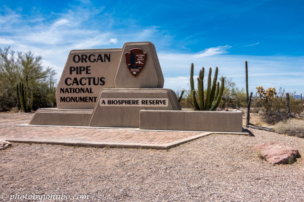
But I digress from the purpose of this post, to share information and photos from our visit to the National Monument. Interestingly enough, on our visit to the park, the only actual organ pipe cactus we saw were right near the entrance. You can see them in the opening photo. You won’t find any other images of this interesting cactus anywhere in this post.
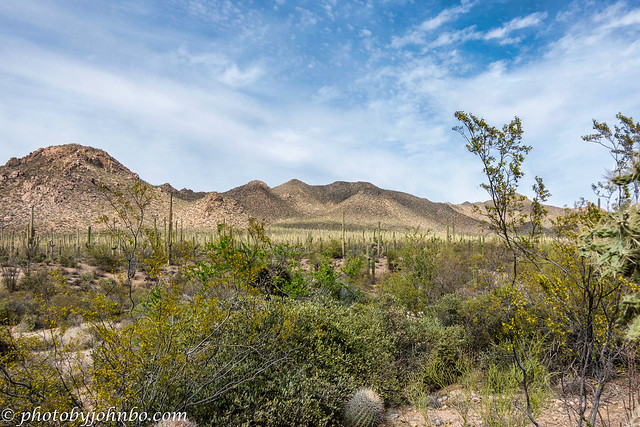
The photo immediately above features a panoramic view of the area and one of the roads/trails that are found in the park. Unlike the national parks around the United States, this national monument is a part of the United Nations Educational Scientific And Cultural Organization (UNESCO). The goal of the reserves in the U.N. program is to conserve samples of the world’s ecosystems. There are 56 such reserves in the United States and another 275 or so reserves in the rest of the world.

This monument was created in 1976 as an example of a pristine section of the Sonoran Desert, an ecosystem that is found only in southern Arizona and northern Mexico (with a small portion in extreme southeast California.) Thank you to the blogger who provided a map of the Sonoran Desert here.
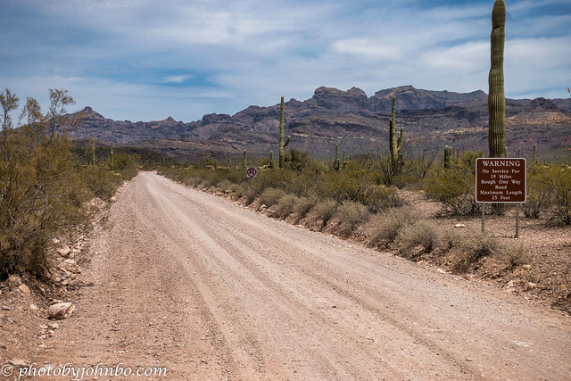
Signs on the roadside indicate the various hazards. Though some of the roads are labeled as suitable for passenger cars, you can expect a rough ride. We started down one such road in a large SUV and decided it was too uncomfortable for us to continue on. We turned around and headed back to the main highway. Of course, those with Can-Ams and other desert vehicles will find these roads highly to their liking.

Bikes are not allowed on the hiking trails but are allowed for daytime use only on any of the roads open to vehicle traffic. The Ajo Mountain Drive is popular for bikers. This 21-mile (34 km) drive is the most popular, but RVs over 25 feet are prohibited due to the rough nature of the road.
Views of the desert abound and you will find that Puerto Blanco Drive is another popular road. There are two loops since its rework in 2014, and the 41-mile (66 km) trip could take five hours to transit given the nature of the road. It leads to Pinkley Peak where from there on, high clearance vehicles are recommended. We did not attempt this drive on our trip, but for those with the proper equipment, I’m sure it’s a beautiful drive.
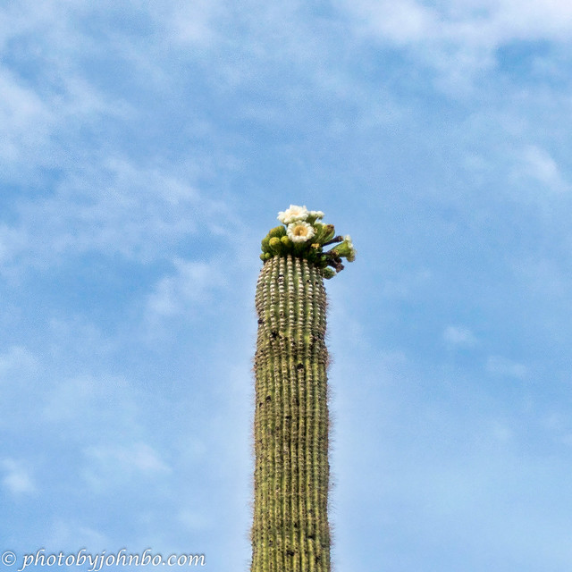
In April, the mighty saguaro cactus can be found blooming in the Sonoran Desert, the only place in the world where these giant succulents grow naturally. The desert is comfortable in the late autumn, all winter (when it can get quite chilly), and in the spring, but it is exceedingly hot in the Arizona summer. Any trips to this part of Arizona should include plans for safety, plenty of water on board, and an admonition that cell phone service is spotty.
The road from Lukeville into Mexico is relatively popular at certain times of the year as it is the road to Puerto Penasco, also known to the Arizonans who travel to this resort area regularly as Rocky Point. This beach resort on the Gulf of California (Sea of Cortez) is about a 75-minute drive (101 km) on Mexico Highway 8.
I have a gallery of photos on my Flickr page featuring other views of the park, and the Lukeville border crossing area (including a photo of a section of the wall built during the Trump Administration.) You can click on any of the images above to scroll through the gallery or view the entire album here.
John Steiner

I love those wide-open spaces, John! Looks like a place right up my alley with those rough roads keeping the crowds at bay.
It sure kept our “crowd” away. >grin< At one point, I considered buying a Jeep for just such explorations, but never did.
This is one our many favorite national monuments. The desert landscape was breathtaking and the scenic drives enjoyable even if the roads were rough. We were there in early February, the weather was cool, we had a few snowflakes during our stay. Nearby Ajo was a pleasant surprise in the remote desert. Thanks for taking us back to this wonderful place.
I am happy you enjoyed our journey. Maybe someday we’ll return with a vehicle more appropriate to the terrain. 🙂
I love this sort of wide open desert environment 🙂 And I especially like your shot of the Saguaro cactus blossoms – beautiful!
They are hard to capture from the ground and are around for such a short time. I’d love to get a drone shot from above or beside the blossoms, but they aren’t allowed in our national parks and monuments.
What a neat place! I’m drawn to the photo of the saguaro cactus blooming.
It is, indeed! Thanks for stopping by!
Is the pipe cactus a family member to the saguaro?
I had to look it up because I didn’t know. 😀
They are completely different species in the cactus family.
They kind of look like a one armed saguaro.