Fargo, North Dakota.
Since my first flights as a youth in the 1960s, I’ve been interested in aviation. Our family didn’t have a lot of money, certainly none to be wasted on expensive aviation fuel, but a couple of lucky occurrences got me in the air at no cost to me.
Throughout my careers in electronics and education, and with the demands of raising a family, aviation was on my back burner. There was the occasional air show and business related trips, but other than that, I didn’t indulge in any activity that got me into the proximity of an airport.
This digression is brought to you by Stephen Bentley. Last week, he gave us a Travel Tuesday tour of The Ruins at Bacolod on Negros Island in the Philippines. He asked if I would share something about my aviation activities for his blog at Expat in Bacolod. Back to my digression…
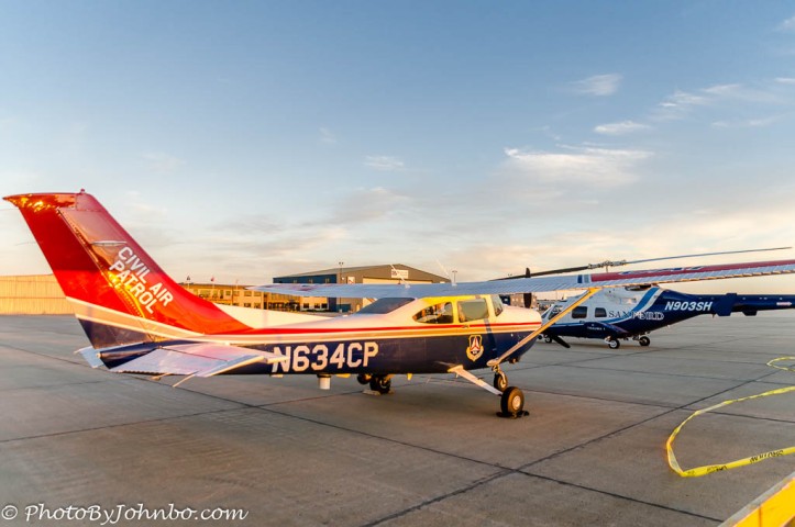
Then 1996 happened, and a local airport had a fly-in, the aviation equivalent of a classic car get-together. I decided to take a helicopter ride and I was hooked. I had to do something about this “flying thing.” A few weeks later, I was at a flight school in Fargo asking about what I needed to learn to fly. I connected with a flight instructor who happened to also fly for the Civil Air Patrol (CAP). Before then, I was totally unaware such an organization existed. Shortly after getting my shiny new pilot’s license, I joined CAP. My first training flight is now over two decades ago, and in October of this year, I become a 20-year member of CAP.
Since its formation in 1941, CAP has performed admirably as an all-volunteer civilian aviation organization. Sometime after its inception, it became an auxiliary of the United States Air Force and today, when assigned an Air Force activity or mission, CAP is a non-combatant component of the Air Force “Total Force” concept. CAP’s motto is “Always Vigilant”. Cap volunteers around the country are ready to assist in many service missions. CAP members are not aerial warriors, indeed members are constrained by law from any law enforcement or surveillance missions of any kind.
As a service auxiliary to the U.S. Air Force, CAP provided me with connections to both the aviation and military communities that I’d never imagined. Though several of my family members served in the military, I didn’t have the opportunity to serve. CAP gave me an outlet and a purpose as a middle-aged man to provide a volunteer service to my country. As a bonus, I have the opportunity to fly and ride in airplanes while performing that service.
CAP has three major missions; Aerospace Education, Cadet Programs and Emergency Services. For the bulk of my two decades in CAP, I’ve focused on Emergency Services as a specialty. At any time, CAP could be called upon to assist in a search and rescue mission or in some form of disaster relief. I have been directly involved either as a flight crew member or as staff on a mission base in searching for missing persons or tracking the route an overdue aircraft. Most often, however, I assist in damage assessment in spring flooding along one of our many rivers in North Dakota.
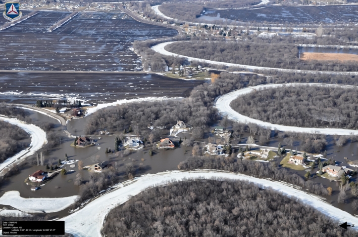
Typical assessment missions include flying along major tributaries in the state capturing photos of specific areas requested by our state’s Division of Emergency Services. The results of CAP flights help them in planning and deployment of resources to mitigate potential flood damage. The image above shows the small town of Oxbow, ND was in serious trouble during the 2010 Red River flood.
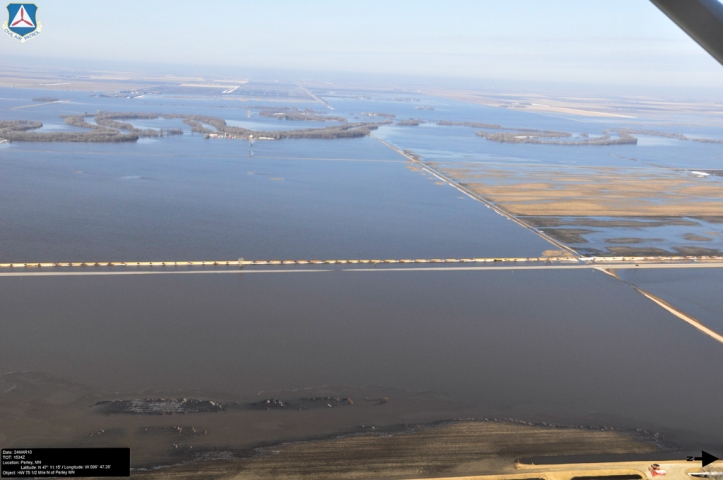
The Red River is the border marker between North Dakota and Minnesota. In the spring, the rivers fill up with runoff from the snow that melted in the fields. When the river fills, there is no place for the snow melt to go, so it covers the landscape threatening farms and communities in a phenomenon called overland flooding. In 2010, this was a view of the overland flooding that surrounded the Red River north and east of Fargo, ND. The river itself normally winds its way along the tree-lined river bed near the top of the photo. The highway next to the train tracks in the center of the image is U.S. 75.
A major area of concern during flood season in North Dakota is the many earthen dams. In 2010, this dam near Absaraka, North Dakota had a damaged and eroded spillway due to the high water behind the dam. Normally, a spillway should have a relatively smooth surface. The rough appearance is caused by erosion of the spillway bed. Photos captured during this mission were instrumental in determining that major work would need to be done to ensure the spillway didn’t completely erode causing the dam to fail. In a short time, this area was filled with construction equipment as they worked to build a temporary repair.
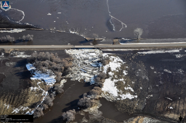
Another area of concern is ice damming. As the river ice breaks up, it flows along the surface and the high water level causes ice to back up against lower clearance bridges. The rising water behind the ice dam creates extra hazards for the property upstream of the blockage. State workers are dispatched with an excavator with a large bucket to pluck the ice from the edge of the bridge and pile it where it can melt into the downstream side of the river.
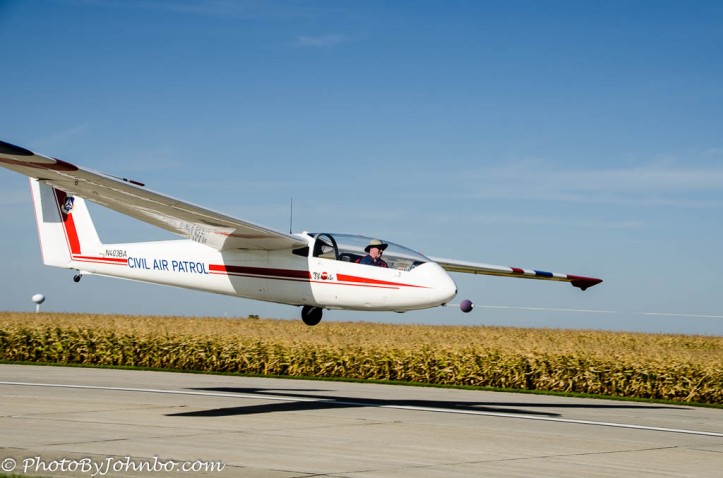
As part of the CAP Aerospace Education mission, cadets between the ages of 12 and 18 are provided with orientation rides in both powered aircraft and gliders. The flights are specifically NOT flight instruction, but a curriculum is defined that teaches the cadets about the aerodynamics of flight in a real world laboratory at least 1,000 ft (305 m) above ground level. Gliders are also used to capitalize on their two major advantages. A glider experiences total aerodynamics effects without the influence of an engine and propeller. It helps that glider rides are much less expensive than powered flight, even including the expense of a powered plane towing the glider to altitude. More flights can be given per cadet due to the lower cost of glider flight. In the image above, a cadet orientation glider pilot is flying solo, meeting currency requirements for carrying a passenger. As you can see by the presence of the tow rope on the nose of the glider, he is just taking off on one of the required three solo take-offs and landings to meet currency.
I have flown a glider solo, and even though I have over 60 glider flights in my logbook, I found that I prefer to fly the tow plane. This image of a gilder on tow was captured with a camera mounted in the back window of the tow plane. In a given day, I can log 10 to 20 take-offs and landings in the powered plane in short 10 to 15 minute flights. Once the glider is airborne and released, I return to the airport and wait for the glider to land. Gliders are very efficient flying machines and it’s not uncommon for there to be a 20 to 30 minute or longer wait after I land before the glider returns for another trip.
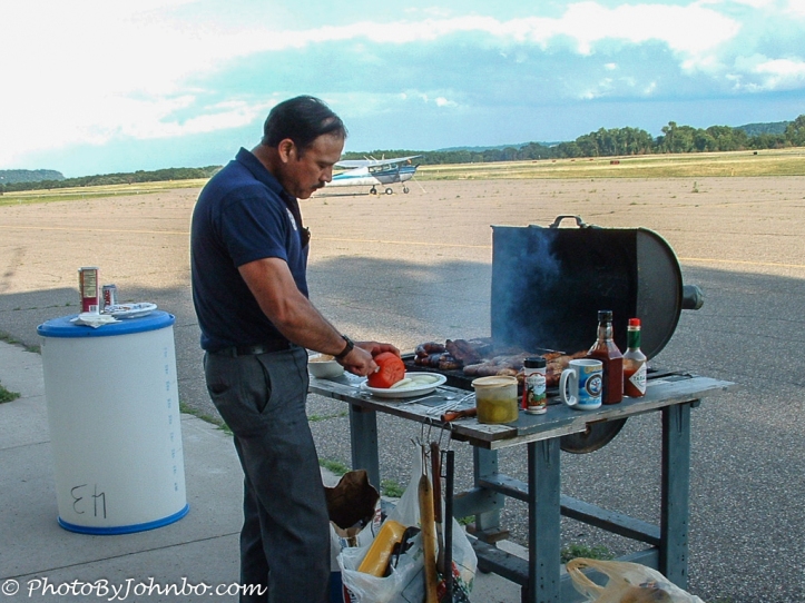
In the meantime, I can relax on a nice summer day, maybe grab a burger, chat with the ground crews and await the return of the glider for another flight.
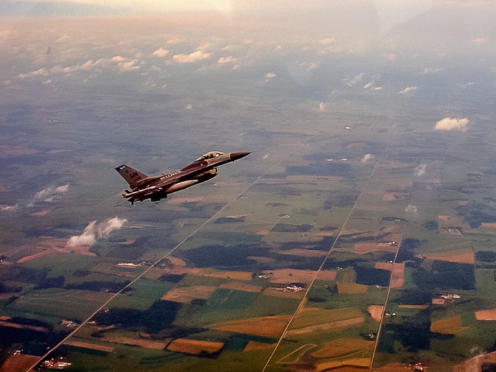
If you happen to be flying along in your little Cessna 4-place airplane, and one of these pulls up along beside you; that will be the first sign you are in trouble. The U.S. Air Force and National Guard have to be ready to interdict aircraft that stumble into protected airspace, inadvertently or on purpose. Fighter jets aren’t designed to fly at the slower speeds of small private aircraft and the military pilots need training in procedures and techniques for interdiction. CAP aircraft and pilots are called upon to help with that training. I was along on one such mission. Our role was to fly into a pretend restricted airspace and to further pretend that our radio was either turned off or inoperative. When we flew into that “protected space”, two fighter jets were dispatched toward Fargo from Duluth, Minnesota, about 220 miles (356 km) away. In only a few minutes, an F-16 appeared off our left wing and started making slow speed circles around our aircraft.
As we proceeded, the other F-16 pilot stayed “at our six”; well behind us, obviously readying to fire those (hopefully) unarmed “missiles” aimed in our direction. Pilots in the U.S. have been given procedures to follow should they become intercepted. Basically, the procedure is to land at the nearest airport where authorities will be waiting. Failure to comply could be quite hazardous to your health.
By providing a target, CAP assists these military pilots in practicing the interdiction procedures while flying at their aircraft’s minimum safe flying speed. The high nose-up attitude of the fighter in the image indicates the slow speed at which he is flying. Though it looks in the image like we are nose up as well, we are not. We are flying straight and level at our maximum cruise speed.
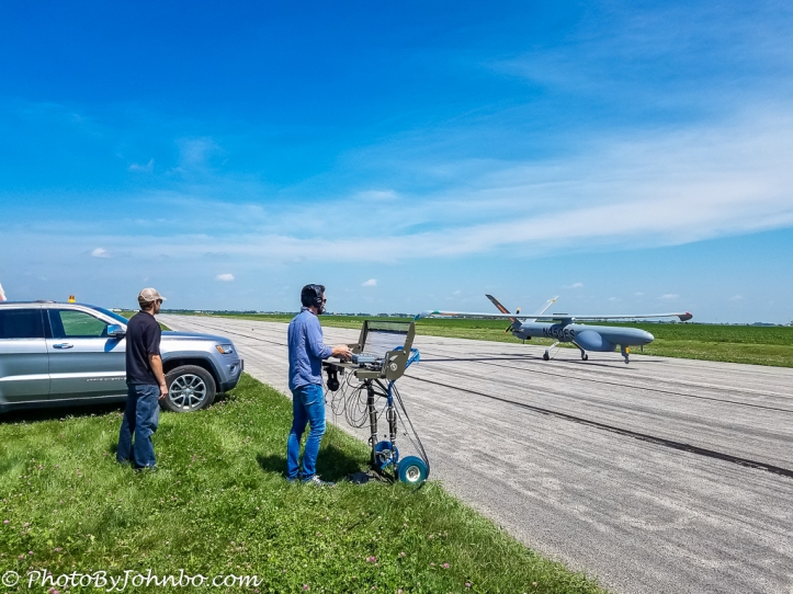
Some of CAPs most recent missions involve the latest technology Unmanned Aerial Systems (UAS). The small camera systems are being integrated into search missions for accessing search areas inaccessible by ground and not easily visible by large manned aircraft. CAP is also involved in research and assistance in integrating the larger UAS aircraft into the national airspace system. Last summer, in North Dakota, several CAP aircraft and 32 members of our wing were involved in an agricultural research project. CAP aircrews followed a large unmanned aircraft as it flew through public airspace. In the image above, professional pilots fly the UAS. Once out of sight from the ground, the UAS presents a limited forward view to the pilots on a small monitor. At all times when the UAS is out of visual range from the ground, a CAP plane follows from behind and below while in full communication with the UAS pilots in case the UAS must be maneuvered to avoid other aircraft in public airspace.
These days, I don’t get as much flying in as I used to. I have taken on a new volunteer job for CAP as the Wing Commander for North Dakota Wing. In this role, taken on almost a year ago, I’m responsible for providing leadership and direction to the 150+ adult and almost 70 cadet members. Our state has a small wing with only 7 aircraft and 9 squadrons. CAP membership nationwide is around 55,000, with access to over 550 aircraft; the largest fleet of single engine aircraft in the world. CAP members are “Always Vigilant” and ready to serve in any capacity in which we are called.
John Steiner
*photo credit: The CAP photographs of North Dakota flooding above were used with permission of the State of North Dakota Department of Emergency Services, the owner of these images.
*photo credit: The F-16 photos were captured by Lt. Col. Gerald (Jay) Manley on this training sortie.





What a fantastic adventure. Thanks for sharing the photo’s and describing it to us. Great post!
Thank you. It has been an adventure.
[…] from around the world and became friends with some of them. John Steiner is one such friend. He writes on his blog […]
Whoa! Super interesting, who knew how little I knew about this organization you’ve been part of for quite some time? Thanks for the overview!
Mostly my fault… I don’t usually say much about it. 😀