Goodyear, Arizona
This week we are challenged to find the longer way between two points. From the challenge post: “The quickest way between two points might be a straight line, but it’s rarely the most interesting one. From strolling around a new city to browsing the shelves at a neighborhood bookstore, it’s so often the unexpected turns that give meaning to our journeys.” You can read the original photo challenge post here.
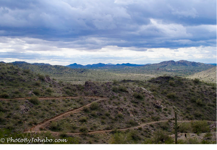
The engineers who design hiking trails often opt for the longer way up sloping terrain. That straight line may be the shortest distance, but it’s often the most arduous. Hikers don’t call them “zigzags”, the term most used is “switchback”. I submit for your considered study in back and forth, my take on the challenge Zigzag.
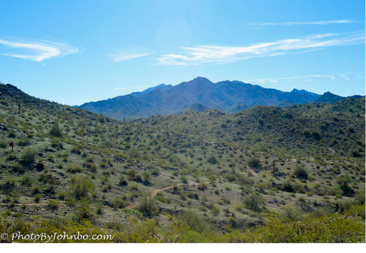
In the photo above, the view from the Rainbow Valley Trail in Maricopa County’s Estrella Mountain Regional Park features a switchback that could have been carved by the mighty sword of a giant “Zorro”. Most switchbacks are less sharp in their zigzags as demonstrated by the photo below of a less pronounced example. By the way, trail managers highly discourage taking the shorter path. Human feet trample the natural turf in the area being “cut through”, and an unlucky hiker may just find a nasty ol’ rattlesnake that isn’t too happy to have its turf ruffled up.
Enjoy the views from the hiking trail. Take the extra time and steps to stay on the trail. Sometimes the quickest way between two points is clearly the least desirable.
John Steiner

Oh this makes me homesick for AZ. I lived in Gilbert and taught in Mesa from 2005 -2012!
As a recent retiree, only in the last few years have I discovered the beauty of the Sonoran Desert. It’s too hot for me there now, but we’ll be back in Buckeye soon… at least until May! Thanks for the comment.